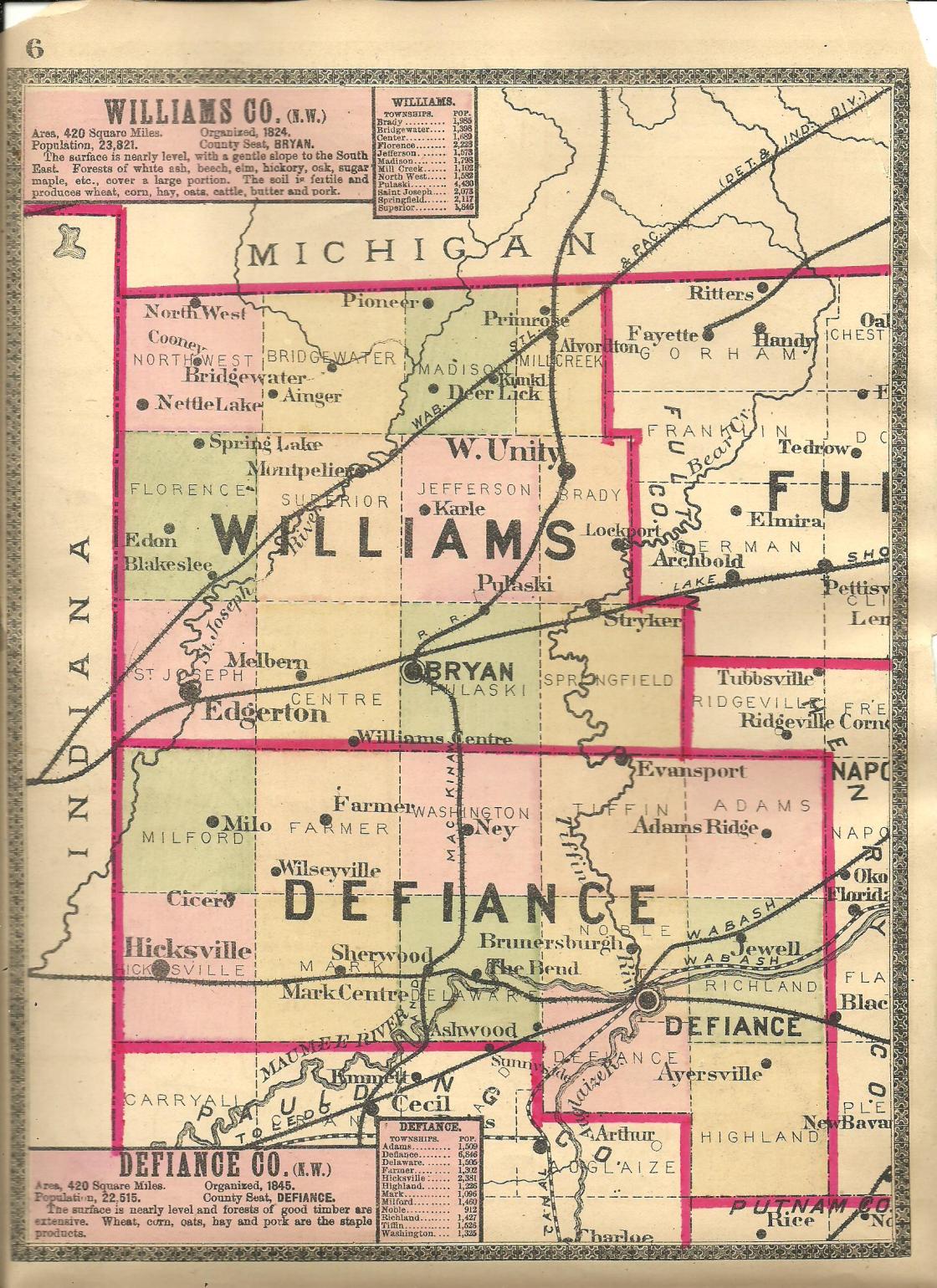
Baldwin – Jefferson Township
Location: 41.583123, -84.497081
on Williams County Rd 17 at the former railroad crossing between US Hwy 20A and Williams County Rd K (Brown Rd) along Beaver Creek
Remnants: none known
Description: Baldwin was on the Wabash Railroad in the early 1900s but it didn’t have a train station. There were 2 local schools. Jefferson Township No. 1 was on the north side of US Hwy 20A about 1 1/4 miles northeast of the GPS coordinates on a 160-acre farm originally owned by the Lantz family and later the Denman family. Jefferson Township No. 2 about 1 1/3 miles northwest of the GPS coordinates in the northwest corner of the intersection of US Hwy 20A and Williams Co Rd 16 on a 160-acre farm owned by the Welch family. Pleasant Ridge United Brethren Church was originally in the southwest corner of the same intersection. It moved to the present location just to the north sometime between publication of the 1904 and 1918 county atlases. The former railroad path is now a 63-mile paved recreational path called the Wabash Connonball Trail.
Trail Info – https://www.wabashcannonballtrail.org/
Deer lick – Madison, Jefferson, and Superior Township
Post Office: 1847 – 1889
Location: 41.617726, -84.574271
on Williams County Rd 13 (Airport Hwy) at the intersection of County Rd N along the St Joseph River
Remnants: Madison Church on the south side of Co Rd N 65 about 1 1/2 miles northeast of the GPS coordinates
Description: The town was named after a local spring which was a little salty and attracted deer. Elias Barrett (born c. 1796 – 1870) was the first postmaster. He married Elizabeth (Herbst) Barrett (1796 – 1852). They moved to Ohio from Pennsylvania and had a large family. Their burial location in unknown. The closest school was 3/4 of a mile south of the GPS coordinates in the southwest corner of the intersection of Williams County Rd 13 and M50 (Co Rd M50). Another school was about 1 1/2 miles northeast of the GPS coordinates on the north side of Co Rd N 65 on land owned by the Wallace family. Some residents attended the church across the road, presently the Madison Church of God. The other known postmasters were Hiram L. Gifford, James Porter, Daniel Brown, Huldah Porter, again Daniel Brown, William B. Anderson, and M. Anderson.
Denmark – St. Joseph Township
Post Office: dates not listed
Location: 41.488699, -84.729963
on County Rd 5 at the 3-way intersection of Co Rd E-75 and Co Hwy 24 along the St Joseph River
Remnants: historical marker at the site on private property in the southeast lot of the intersection
Description: It was platted around 1836 by Judge Payne C. Parker (born c. 1972) from England and was the first village in Williams County. Payne previously served as a justice of the peace from 1825 – 1827. Denmark had a public square, general store, tavern, log schoolhouse, ashery, a church congregation, and a post office. Payne was the only postmaster. The tavern was at his house, a wood frame structure also built in 1836. It wasn’t officially a hotel, but travelers often stayed overnight and left their families there while venturing out to look for land to purchase in the area. Daniel Farnham (1811 – 1896) ran the store, selling good for Payne. He was buried with relatives in Farnham Cemetery 6 miles southwest of the GPS coordinates on the south side of Co Rd 1. Denmark never attracted a canal or railroad and couldn’t compete with nearby towns which were growing faster. The plat was vacated by the county court in 1841. The last record concerning Payne is in the 1850 census. His wife’s name was Jane (born c. 1798) from New York. She had several children with Payne. Their burial location are unknown.
Freedom – Center Township
Location: 41.426868, -84.598283
on the north side of Wms Def Co Line Rd between SR 2 and Co Rd 12
Remnants: none known
Description: Freedom was platted in the southeast quarter of section 35 in February of 1836 by Montgomery Evans, Nathan Shirley, and Thomas Warren. It was intended to be a centrally located future county seat back when the land comprising of Williams and Defiance were one county. The current City of Defiance was the county seat at the time, but there was a lot of talk about moving the seat. Freedom didn’t compete well with Centre, now Williams Center, which was platted with the same intention just a few weeks prior in January of 1836 in the southwest quarter of section 35. The town was abandoned in 1842 and the borders changed in 1845 as Defiance County was formed. Although Williams Center survived the county split, it’s just a shadow of what it could have been. The City of Defiance remained the seat of Defiance County and the Williams County seat moved to Bryan which was platted in 1840.
Fuddletown – Bridgewater Township
Location: 41.621439, -84.659810
on County Rd 8-50 at the intersection of Co Rd N-30 along Nettle Creek
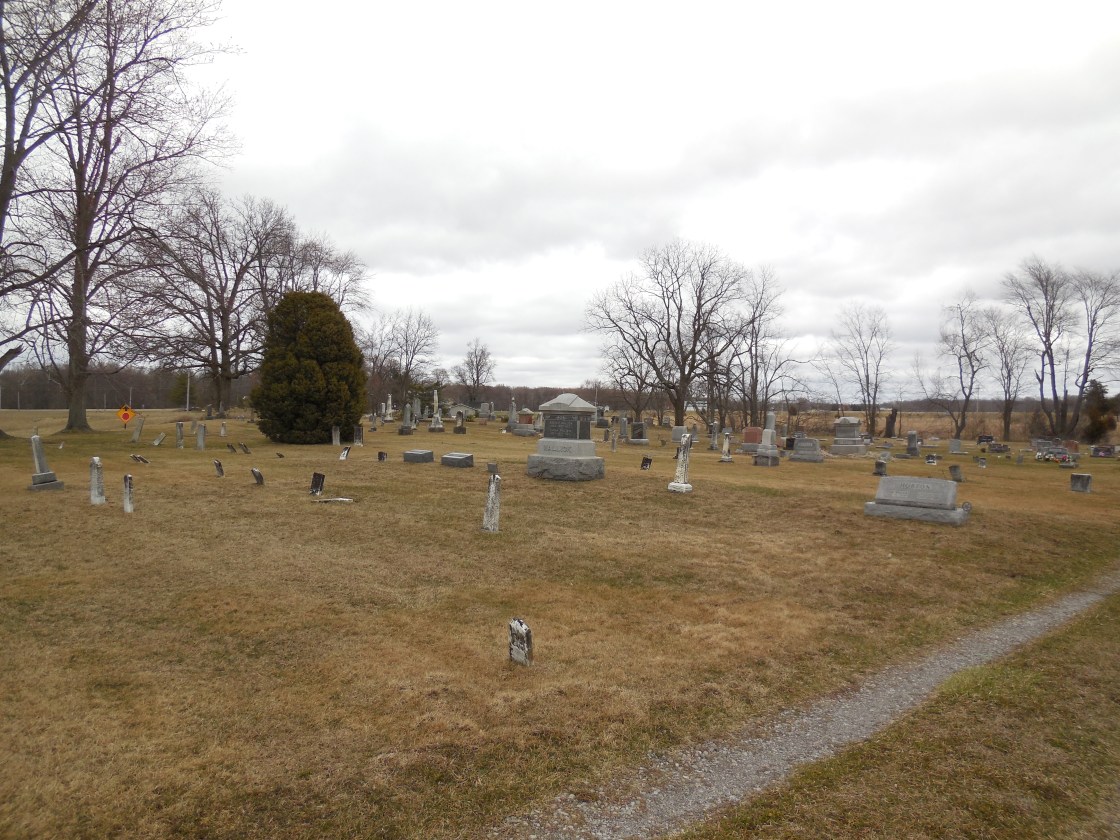
Remnants: Heritage Cemetery at the GPS coordinates
Description: This crossroads town had a school (Bridgewater Township No. 9) 1/2 of a mile west of the GPS coordinates on the south side of Co Rd N-30. Babcock & Strong started a lumber company with a steam-powered saw mill in 1870. They subsequently sold it to Abner K. Brown (1838 – 1897) from Stark County and Amanda (Bollinger) Brown (1842 – 1920) from Seneca County. Abner and Amanda got married in 1862, owned a 150-acre farm in the northeast lot of the GPS coordinates, and had 8 children. They were buried with relatives & many residents of Fuddletown in the cemetery.
Lukes Corners (Luke’s Corner) – Florence Township
Post Office: 1854 – 1867
Location: 41.570927, -84.749699
on Williams County Rd K at the intersection of Williams Co Rd 4 along Matthews Creek
Remnants: none known
Description: The proprietors were Judge John Luke II (1801 – 1875) and Mary (Micum) Luke (1802 – 1880) from Northumberland County, Pennsylvania. They had a large farm at Lukes Corners, 9 children, and John was the postmaster. The town fell into obscurity shortly after the post office closed, at least partially due to the success of nearby Edon which was platted in 1867. John and Mary were buried with relatives 4 1/2 miles northwest of the GPS coordinates in Leggett (Ligett) Cemetery on the north side of County Rd M-50.
Mazes Corners – Center Township
Post Office: 1842 – 1849
Location: 41.499680, -84.671143
on Williams County Rd F at the intersection of Williams County 8
Remnants: none known
Description: The town was founded by Robert Maze (1798 – 1851) and Sarah (Mitchell) Maze (1802 – 1887). They were married in Union County in 1823 after Robert’s first wife passed away and moved to Williams County around 1841. Robert was the postmaster and an Evangelical Lutheran minister. The Mazes had 8 children. Robert was buried with relatives in West Buffalo Cemetery 2 1/3 miles northwest of the GPS coordinates on the southeast side of Rd 5G (Co Rd 5G). According to Sarah’s obituary in the Bryan Press, she was unable to be buried next to Robert in West Buffalo cemetery due to “unfavorable circumstances”. We have no clue what that means. In any case, she was laid to rest with relatives in Pease Cemetery at the intersection of County Rd S and County Rd 11-50 (Co Rd 1150) in Bridgewater Township.
Phalanx – Springfield Township
Post Office: 1844 – 1849
Location: 41.476699, -84.413664
on SR 191 at the 4-way intersection of SR 2 and SR 34 along the Tiffin River
Remnants: Boynton Cemetery 1 1/4 miles west of the intersection on the south side of SR 2 / SR 34
Description: The proprietors were Harmon Doolittle (1810 – 1849) from Connecticut and Martha (Stubbs) Doolittle. Harmon arrived in the township with along with other members of the Doolittle and Stubbs families in 1833. Martha’s parents, War of 1812 veteran John Stubbs (1784 – 1884) from Orange County, New York and Phebe (Miller) Stubbs (1794 – 1869) from Broome County, New York, purchased nearly 1,000 acres of land in what would later become Springfield Township. Harmon and Martha got married in 1834 and had 4 children. They built a saw mill 1 1/4 miles west of the GPS coordinates along the Tiffin River. Its unknown how long the mill was in operation, but it was later the site of the township’s Eagle Mills. Harmon served as a justice of the peace from 1837 – 1838, a county commissioner 1847 – 1848, and was the first postmaster of Phalanx. Someone by the name of T. Doolittle took on the postmaster position shortly before Harmon passed away. Harmon was laid to rest with relatives, including Martha’s parents, in Boynton Cemetery. The Boynton and Doolittle families were related by marriage. Sophia (Doolittle) Boynton (1834 – 1857), a daughter of Harmon and Martha, married Charles F. Boynton (1824 – 1900). Unfortunately, she died during birth of their first child. They were also interred in Boynton Cemetery. Martha likely remarried after Harmon died and it’s unknown where she was buried.
Singers Corners – Florence Township
Location: 41.570921, -84.769122
on SR 49 at the intersection of Williams County Rd K
Remnants: none known
Description: It was founded by German immigrants David Singer (1808 – 1871) and Margaret (Kragore or Creger) Singer (1810 – 1888). They were the first settlers in the township and had 8 children. David was one of the settlers who left his family in Denmark, earlier mentioned in this county, while he went out to search for land. He built their cabin on section 9 of Florence Township in 1836 – 1837. A Methodist Episcopal church was in the southwest corner of the intersection on land owned by the Allomong family. As with Lukes Corners just a mile to the east at the next intersection, Singers Corners also faded out of existence as Edon won the area’s competition for residents and businesses. David and Margaret were buried with relatives in Edon (Edon Union) Cemetery 1 1/3 miles south of the GPS coordinates on the east side of SR 49 (S Michigan St).
Smith Settlement – Bridgewater Township
Location: 41.643585, -84.611613
on US 20 at the 4-way intersection of SR 576 and Co Rd 11
Remnants: Cogswell Cemetery about 1/2 of a mile southwest of the GPS coordinates on the west side of County Rd 11-50 (Co Rd 1150), former one-room schoolhouse 1/2 of a mile east of the GPS coordinates in the northwest corner of the intersection of US 20 and County Rd 11-50
Description: Smith Settlement was founded in 1836 by Asa Smith (1810 – 1892) from Cattaraugus County, New York. He purchased three tracts of land, one for himself, his brother Anson, and another for their father Daniel. They all moved to their respective farms with their families in 1837 after spending a year making improvements on them and became the first permanent settlers of the township. Asa served as the township’s superintendent of roads, treasurer, and a constable. The former one-room schoolhouse appears to have been recently converted into a private residence. Asa was buried with his wife Rebecca (Bird) Smith (1808 – 1885) from Massachusetts, a few other relatives, and many of the town’s residents in Cogswell Cemetery.
West Buffalo – Florence Township
Post Office: 1854 – 1874
Location: 41.515689, -84.693905
on SR 34 at the 4-way intersection of Rd 5g (Co Rd 5G) and Township Rd 7g along the St Joseph River
Remnants: West Buffalo Cemetery just southwest of the intersection on the southeast side of Rd 5G
Description: West Buffalo was platted with 157 lots in 1836 by John D. Martin who built a dam and saw mill with Elias Depew in 1835 next to the St Joseph River. They constructed their family residences with lumber from the saw mill and constructed a grist mill in 1838. John sold the town plat to Eilias and his brother, John Depew, later that year and sold his partial ownership of the mills to John Depew in 1840. Although the mills were popular and received a lot of business, they didn’t help with attracting residents to West Buffalo. Only four of the lots were purchased and those were basically bought as an investment by someone who never moved there. The Depew brothers sold the plat in 1847. More residents later moved to the area though. There was a school in the southeast corner of the intersection, a blacksmith shop, and general store. The known postmasters were Daniel W. Wright, John J. Webb, S. J. Adams, P. D. Pelton, and David Maze. Despite the resurgence West Buffalo had, it faded out of existence prior to publication of the 1882 county history book. One of the most interesting gravestones we’ve ever seen is the highly-detailed log cabin shaped stone of William Stenger (1849 – 1900) in West Buffalo Cemetery. William owned a farm on Rd F in nearby Center Township.