
Broadwell, OH – (mid-1800s – present farming and coal mining town abandoned over time)
Classification: semi-ghost town
Location: Bern Township, Athens County – On SR 329 near the intersection of Sand Rock Rd
GPS coordinates: 39.365994, -81.880717
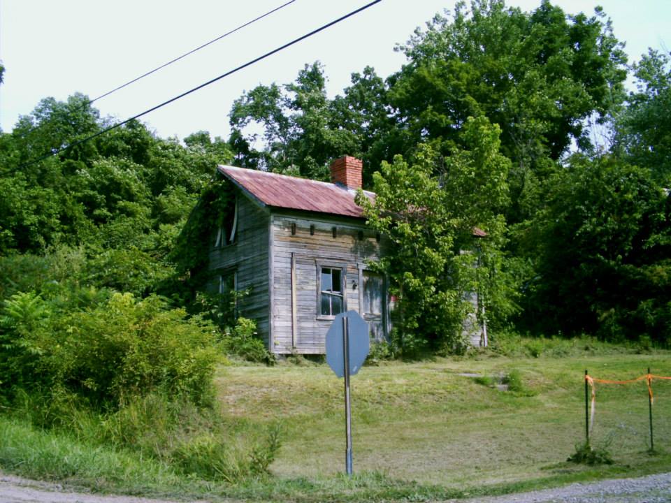
It was settled by Henry Broadwell (1809 – 1881) and Anne Eliza (Wainright) Broadwell (1813 – 1890) in the mid-1800s as a farming community. Their daughter Ann Eliza Broadwell (1846 – 1931) turned into a prominent business entrepreneur and donated land for a train station on the Federal Creek Railroad. Broadwell’s main source of income was from local coal mines operated by The Federal Coal Co.
Ann married Elijah Homer Bean (1843 – 1923) in 1866 and they later moved out west becoming one of the earliest known families to settle in South Dakota. Broadwell had a post office from 1893 – 1919. It lost a lot of residents after the coal mines shut down and has a neighborhood of abandoned buildings where the center of town was.
Sewellsville, OH (Union) – (early 1800s – mid-1900s farming, business, and coal town abandoned over time)
Classification: semi-ghost town
Location: Kirkwood Township, Belmont County – On SR 800 (Hendrysburg – Freeport Rd) at the intersection of McCoy Rd
GPS coordinates: 40.097783, -81.214242
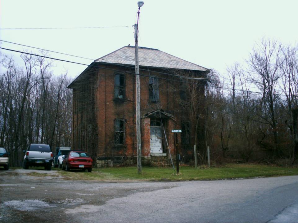
Sewellsville sits on a stretch of road that’s mostly old abandoned buildings. It was once a relatively thriving town that started out as a farming village in the first decade of the 1800s. The town was originally called Union and was named after the first log cabin meeting hall. It was changed to Sewellsville in 1831, named after Peter Sewell. He was a carpenter, builder, and also became the first postmaster. Sewellsville had a post office from 1834 – 1907. The town also had a church, school, and several small businesses over the years. The population was around 125 in 1900.
Later in the mid-1900s, the local surface coal mining industry may have led to Sewellsville’s demise. It gave people jobs at the time but bought up a lot of the town’s land. Most of the remaining residents had to leave and find work elsewhere when coal production ended. The last school is at the intersection of SR 800 and McCoy Rd. An impressive looking and old United Methodist Church is on SR 800 next to the town’s cemetery. There are also a lot of abandoned houses around the area.
Hope Furance, OH – (1854 – late 1930s iron furnace and mining town partially destroyed during the construction of Lake Hope State Park)
Classification: semi-ghost town
Location: Brown Township, Vinton County – On SR 278 north of Zaleski
GPS coordinates: 39.332164, -82.340452
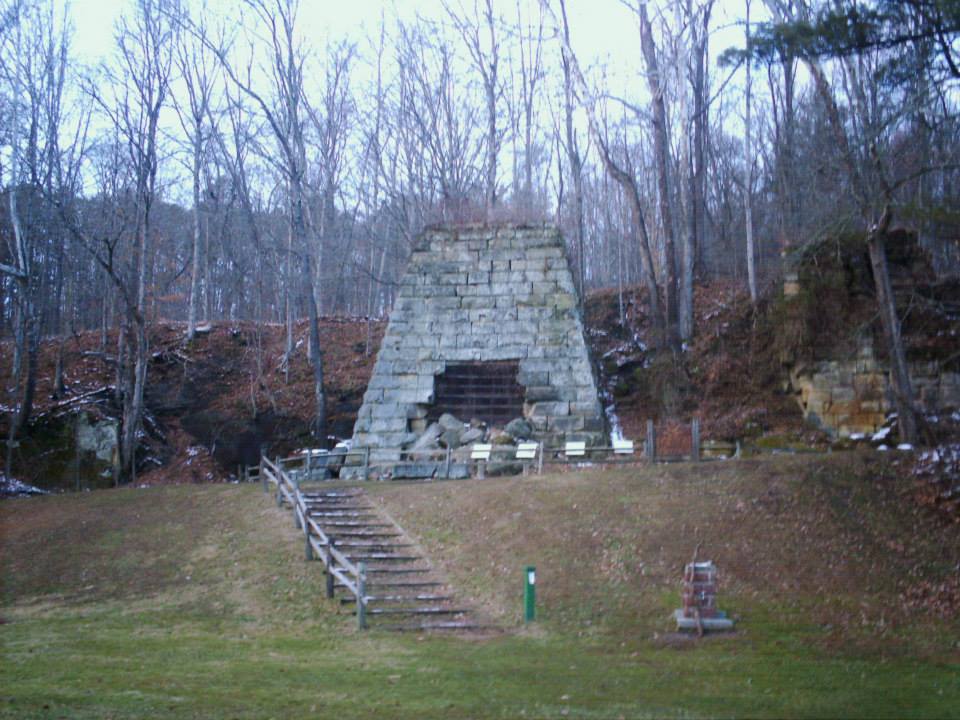
Hope Furnace was built by Colonel Douglas Putnam (1806 – 1894), who was a wealthy businessman from Marietta and also managed a furnace in Ashland County. It started operating in 1854 and had a train station on the Big Sand Railroad. Hope also had a general store, a school, and dozens of homes. The town hit its peak population at around 300 citizens in 1870. Many residents left when the furnace stopped production in 1875. Hope’s post ran from 1865 – 1890. More residents moved away before the late 1930s when construction of Lake Hope began. It eventually submerged a large percentage of the town’s land.
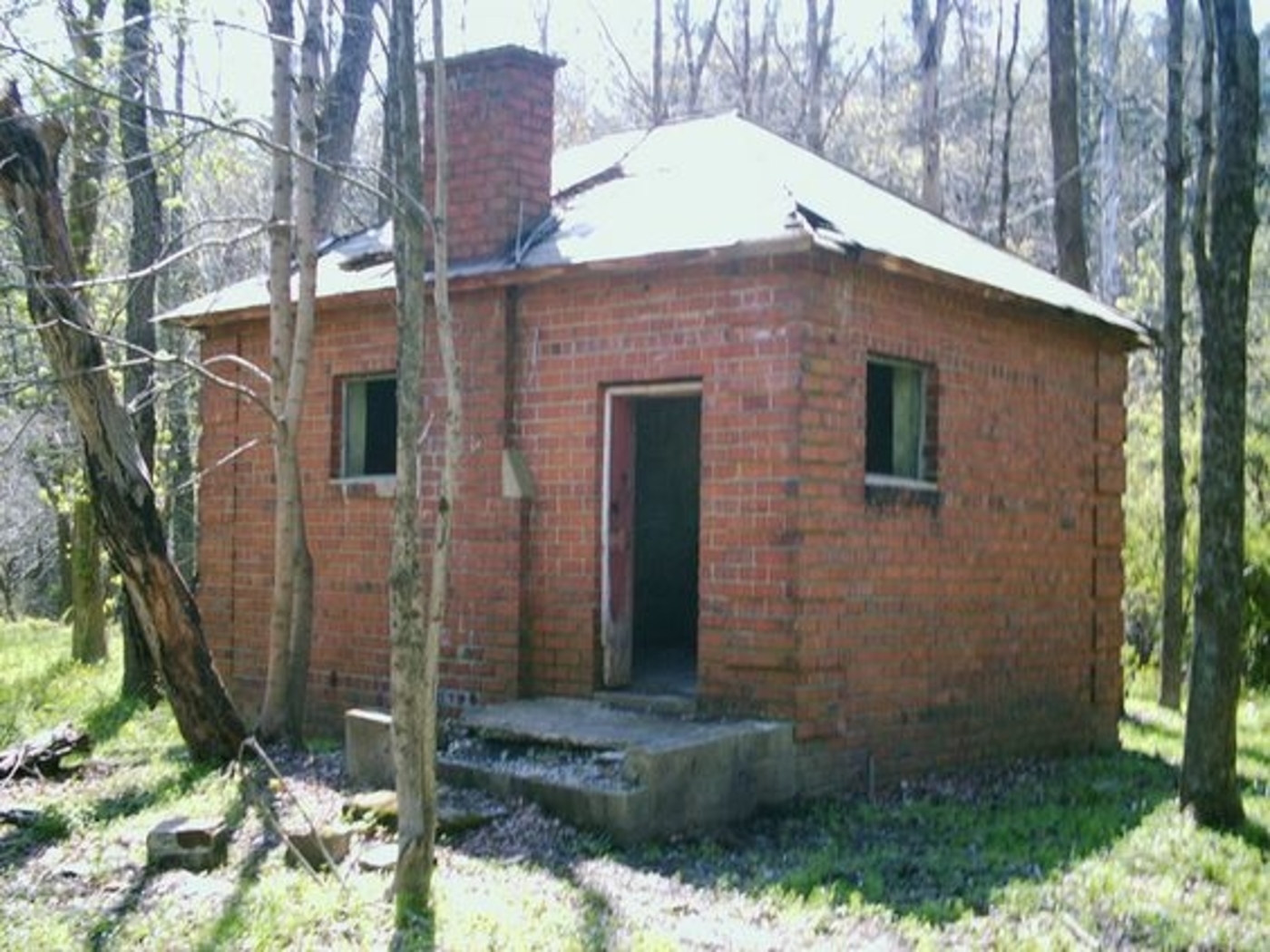
The furnace is near the northeast corner of the lake off of SR 278. It was listed on the National Register of Historic Places in 1973 and is highlighted by Ohio Historical Marker #1 – 82. It’s also reportedly haunted by the ghost of a night watchman who died on the premises and can supposedly be seen making his rounds with a lantern on stormy nights. The former one-room schoolhouse has been restored and is used as a meeting hall. It sits in the forest off of one of the hiking trails. Hope’s last church is abandoned on Wheelabout Rd south of town off of SR 278. Lake Hope has lots of recreational activities to do.
Lake Hope State Park Info – parks.ohiodnr.gov/lakehope.
San Toy, OH (1900 – present mining town that was nearly abandoned but later repopulated)
Classification: semi-ghost town
Location: Monroe Township, Perry County – At the intersection of Santoy Rd and Town Hwy 452
GPS coordinates: 39.637598, -82.034673
The Sunday Creek Coal Company built San Toy in 1900 to house and accommodate its workers. This rough and rowdy mining town at the northern edge of Ohio’s Hanging Rock Region had a roller coaster worth of ups and downs. San Toy boomed from the very beginning and made its best attempt to maintain law and order in a densely populated community. The town’s former jail, at the southwest corner of the intersection of Santoy Road and Township Highway 452, hides out in a wooded lot these days and appears to enjoy the peace and quiet.
Across Santoy Road from the jail, a water well pump house has lost its roof but the walls are still intact. The town’s tough reputation was partly due to its large number of saloons and drinking being the biggest after work hobby. San Toy had the only hospital in the county at the time and needed it for both for the mine workers and those injured in bar brawls and street fights. It also had a theater and a baseball team for entertainment. The baseball team competed against other mining company and small town teams in the area.
In 1924 a group of disgruntled workers pushed a cart full of flaming logs down into a mine shaft during a labor dispute. The fire destroyed the mine, hospital, and theater. After the dispute was settled, mining continued until 1927 when the coal company decided it didn’t want to invest in the location anymore. Instantly losing their main industry, San Toy’s citizens didn’t have many other options and most moved away as soon as possible. A set of steps that don’t go anywhere anymore climbs into oblivion where a house used to be near the jail.
The few residents that stayed behind kept the town going with revenue from making moonshine. Between 1927 and 1930 San Toy lost more residents than any other town in the United States. In 1931, 17 of its 19 remaining citizens voted to abandon the town. There are now newer residences in the area among the remnants of the ghost town and it still goes by the name San Toy.
Cheshire, OH – (1820s – present farming and mining town partialy abandoned in 2002 during a buyout by the Kyger Creek Power Plant)
Classification: semi-ghost town
Location: Cheshire Township, Gallia County – On SR 554 at the intersection of SR 7 near the Ohio River
GPS coordinates: 38.944810, -82.111247
Cheshire was settled in the early 1800s and became a town in the 1820s with a post office that started up in 1826. 27 lots were plotted for the town’s growth and the first school was built in 1835. Farming was its biggest source of income for several decades as crops were floated on the Ohio River from Cheshire to as far as New Orleans. Coal was later discovered in the area and Cheshire got a train station on the Hocking Valley Railway. It also had a hotel, several stores, a church, flour mill, and a barrel factory.
In 1863, 2500 Confederates on horseback swept through the town during Morgan’s Raid. The hotel and school dorm were used to house captured soldiers. In 1913 and 1937 Cheshire was devastated by Ohio River floods but the town survived both times. The James M. Gavin (Kyger Creek) Power Plant was built on the west side of Cheshire in 1975. Several old homes and businesses were demolished for its construction. The residents of Cheshire were exposed to soot raining down from the power plant smokestacks and some suffered unhealthy side effects.
Rather than face numerous lawsuits, the power plant owners proposed a buyout of the town in 2002 and offered the residents money to move out of Cheshire. Some left and some stayed, vowing that they would never leave no matter how much they were offered. More homes and businesses were demolished, but In 2004 Cheshire annexed some property to the north and west in the hopes that the town will have a brighter future. The town’s population was 132 as of the 2010 census. Cheshire still has several old buildings in the area.
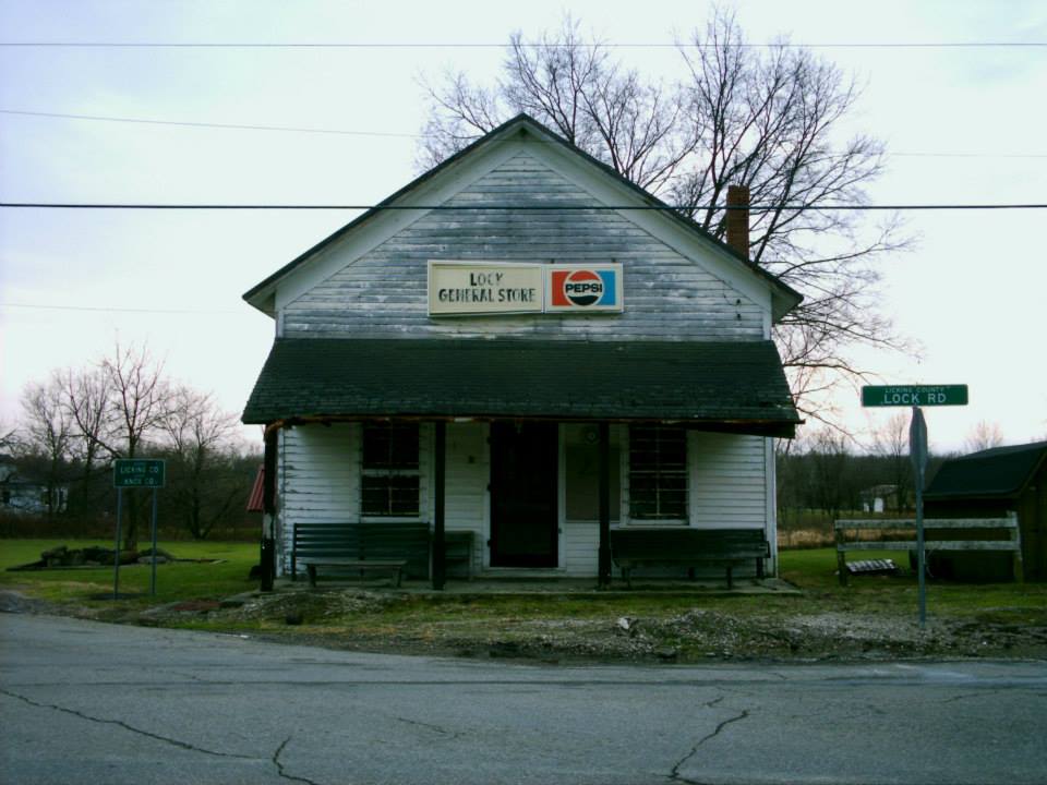
Lock, OH – (1837 – present farming town with less residents than in the past)
Classification: semi-ghost town
Location: Bennington Township, Licking County and Milford Township, Knox County – On Lock Rd at the intersection of SR 657 (Marion Rd NW)
GPS coordinates: 40.271099, -82.610938
Lock was settled by Isham Abbott (1799 – 1859) and Lois (Everett) Abbott (1807 – ?) in 1836. Isham had a potash business and laid out lots for the town in 1837, naming it Lock for unknown reasons. A post office was established in 1838 at his store and Lock got its first church in 1845. The Abbotts later moved out of town and Lock didn’t grow much over the next few decades without a canal or railroad, although it was still the biggest town in the area.
Washington Hildreth (1829 – 1903) was the most prominent business man in Lock during the late 1800s. He was the last postmaster in town and a member of the Ohio National Guard. An atlas from 1871 shows that Hildreth owned 2 stores, a warehouse, and several lots in town, including Hildreth’s Hall where members of the Order of Good Templars held meetings. Around that time, Lock also had another store, a cooper shop, 3 churches, a school, wagon shop, blacksmith, harness shop, and a shoe shop. The 1870s appear to be the peak of Lock’s heyday and the community has been dwindling since then.
The last general store in town, which was built on one of Washington Hildreth’s lots, still stands at the intersection of Lock Rd and SR 657. A Congregational Church constructed in 1844 is across the street. There’s also an old Methodist Church on Lock Rd east of the center of town. Washington Hildreth and many other early residents were buried in Lock Cemetery south of town on SR 657.
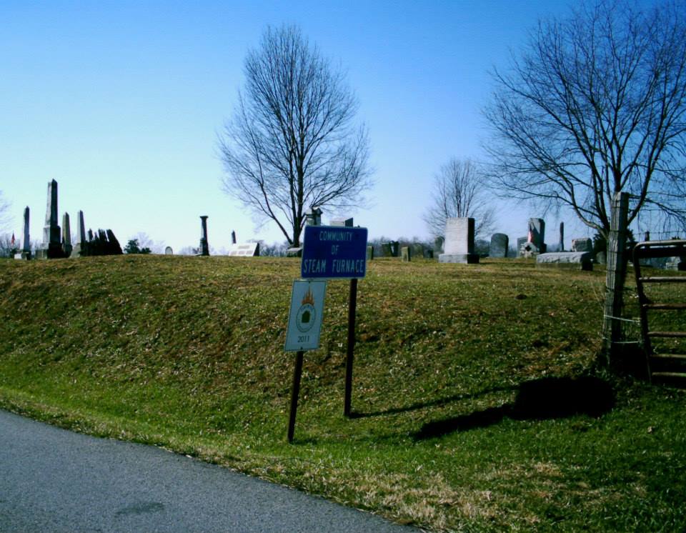
Steam Furnace, OH – (1816 – present iron furnace and forge town partially abandoned when the furnace production stopped in 1826)
Classification: semi-ghost town
Location: Meigs Township, Adams County – On Steam furnace Rd (County Rd 27) at the intersection of SR 781
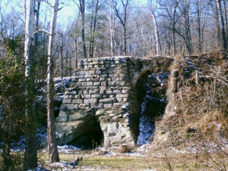
An iron forge was built in 1815 and the furnace was built in 1816 by James Rodgers (1787 – 1860), Andrew Ellison (1755 – 1830), and his son Andrew Ellison Jr. The exact location of the furnace and original town is unknown. It’s is sometimes referred to as “Old” Steam Furnace, as there is a newer community in the area. All the old town really had was the furnace, forge, and a general store.
James Rodgers and Andrew Ellison Jr. went on to build many other iron furnaces in Ohio. Rodgers also managed the Brush Creek Furnace for a few years. Some of the Ellison’s relatives are buried in Brush Creek Cemetery. Steam Furnace had a school across the road from its cemetery in the late 1800s to early 1900s in the northeast corner of the intersection of Steam Furance Rd and John Fristoe Ln. There are some abandoned buildings and old store fronts around the area, including Turkey Creek Church at the intersection of SR 781 and Lucas Rd.

Belmore, OH – (1862 – present farming, mill, and railroad town with less residents than in the past)
Classification: semi-ghost town
Location: Van Buren Township, Putnam County – On Main St off of SR 65
GPS coordinates: 41.154073, -83.941506
Belmore was platted in 1862 by Wesley G. Montgomery (1813 – 1892) and Julia (Plummer) Montgomery (1825 – 1859) with a power of attorney from Julia’s parents, Benjamin and Mary Ann Plummer, who owned the land at the time. It was initially called Montgomeryville but the name changed in 1868 to coincide with the post office that was named Belmore. The town plat had 17 lots to start out with and began to expand with a station on the Cincinnati, Hamilton, & Dayton Railroad in 1869.
In the 1870s, Belmore had a mill, hotel, a couple of grocery stores, and several other small stores and businesses. The population peaked in the 1880s with around 450 residents. Although Belmore was a railroad town, it didn’t get any big businesses in the 1900s to make the population boom. A school was built in 1904 and unfortunately was destroyed in a fire in 1958. The railroad station eventually closed, as did the post office in 1964.
These days, Belmore has a newer railroad line running through its center but no train station. A CSX train passed by when we were there in July 2014. The old town hall built in 1908 sits abandoned on Main St near an empty church. There are also several other old abandoned businesses on Main St and the town’s cemeteries, East Belmore and West Belmore, are on Road Y. It’s a cool place to swing by right off of SR 65 with a close-knit community of about 120 residents.

Dawn, OH – (1854 – present farming, mill, and railroad town with less residents than in the past)
Classification: semi-ghost town
Location: Richland Township, Darke County – On Greenville Saint Marys Rd and Old State Highway 47 off of US 127
GPS coordinates: 40.216071, -84.578515
Dawn was platted in 1854 by Lewis Wesley Johnson (1824 – 1862) who moved to Ohio from Johnsons Mill, West Virginia. Lewis built a saw mill and was also the town’s first postmaster. The post office was originally called Eden when it opened in 1856, but the name changed was changed to Dawn and it ran from 1857 – 1935. When the saw mill in town burnt down, a lumber mill was built on the same spot and later upgraded with a grist mill. It was steam-powered and home to the first stationary steam engine in the township.
Luckily the town got a train station on the Big Four Railroad (Cleveland Cincinnati, Chicago, & St. Louis). The station was called Nevada and sat on the south side of the railroad tracks in the middle of town. In the late 1800s Dawn had a forge, tile factory, general store, blacksmith, doctor, church, and a 2-story school (Richland Township #4). The population declined over the 1900s as the town lost its businesses and the train station.
Dawn still has a small old church on Greenville St Marys Rd on the south side of town. There are also a few abandoned houses and an abandoned auction house that was once called Auction City. The back of the lot is set up like a fort with guard towers on the corners made to look like Fort Brier, which was a War of 1812 fort that was built a few miles southwest of Dawn.
Olive Furnace, OH (Mount Olive) – (1846 – 1915 iron furnace and farming town mostly abandoned after the furnace operation stopped)
Classification: semi-ghost town
Location: Washington Township, Lawrence County – On SR 93 about 1/2 of a mile north of Kimble Creek Rd
GPS coordinates: 38.762626, -82.629723
Olive Furnace was built next to Olive Creek in 1846 and was financed by John Peters, John Campbell (the founder of Ironton, OH), Madison Cole, William Clements, and J. L. Thompson. The furnace provided iron for steel manufacturing during the Civil War and for steel manufacturers in Northern Ohio and other places around the country.
The furnace, coal mines, and the surrounding town (sometimes called Mount Olive) were on 3,600 acres of land that was purchased by the furnace owners. Most of the early roads in the township were built and maintained by the furnace company. Beside the buildings at the furnace, the town also had a blacksmith shop, carpenter shop, company store, church, and a school, as well as a few dozen houses for the workers. The closest railroad station was about 1/2 of a mile of a mile southwest of town on the Cincinnati, Hamilton, and Dayton Railroad. The furnace began operation in 1847 and produced an average of nearly 4,000 tons of iron every year until production stopped in 1910. Farming was also a local source of income.
In 1915 the furnace was sold for scrap iron and a lot of it was destroyed. The Olive Furnace post office ran from 1857 – 1915. Now the land is owned by the Mt. Olive Furnace Park Corporation which is accepting donations with plans to reconstruct the furnace. The Mount Olive Community Baptist Church still stands across the road from the remains of the furnace and Olive Furnace Cemetery is up a hill behind the furnace.
One-Time
Monthly
Yearly
Make a one-time donation
Make a monthly donation
Make a yearly donation
Choose an amount
$5.00
$15.00
$100.00
$5.00
$15.00
$100.00
$5.00
$15.00
$100.00
Or enter a custom amount
$
Your contribution is appreciated.
Your contribution is appreciated.
Your contribution is appreciated.
DonateDonate monthlyDonate yearly