Coopertown (Cooperstown) – Townsend Township
Location: 41.357768, -82.872745
on SR 101 at the intersection of Smetzer Rd
Remnants: Parkhurst Cemetery on the south side of the GPS coordinates
Description: It was founded brothers James B. Stark (1825 – 1905), Lorenzo D. Stark (1822 – 1896)., John Stark (1820 – 1865), and Civil War veteran Albert Stark (1828 – 1873) who were coopers (barrel makers) in the mid-1800s. They were born in New York and moved to Ohio with their parents around 1840. Aside from the barrel factory, Coopertown had a general store owned by Benjamin Bacon (1789 – 1854) from England and William Willis (b. 1801) from England who also owned a shoe shop, and a wagon shop was owned by William Wales (1826 – 1910). The town went into immediate decline when it missed out on the Sandusky, Dayton, & Cincinnati Railroad which rolled through the township a mile northwest of Coopertown. James Stark subsequently moved the cooper shop to Clyde in Green Creek Township in 1852 and opened a grocery store with Lorenzo. There are a few other members of the Stark family interred in Parkhurst Cemetery along with former residents of Coopertown, but everyone mentioned in this listing was laid to rest in McPherson Cemetery 6 miles southwest of the GPS coordinates at the intersection of US 20 and SR 101 (E Maple St) in Clyde.
Demarsville – Rice Township
Post Office: 1857 – 1859
Location: 41.443274, -83.062142
on SR 53 at the intersection of C R 145
Remnants: none known
Description: The proprietor, War of 1812 veteran Thomas DeMars (1795 – 1862), was of French descent. He married Margaret (Bissonnet) DeMars (1802 – 1850), had a few children, and owned a 233-acre farm on the north side of C R 145 which was passed down through the next couple of generations of the family. Thomas and Margaret were laid to rest in LaPrairie (St. Philomena) Cemetery 2 miles south of the GPS coordinates on Cemetery Rd off of Fisher Rd. It’s the oldest Catholic cemetery in Sandusky County. Levi Tilton (1822 – 1901) from New York was the only known postmaster. He married Susannah (Hineline) Tilton (1831 – 1890) and had a few children. The Tiltons owned a 41-acre farm just northeast of the town’s main intersection on SR 53 and were buried with relatives 9 1/2 miles southwest of the GPS coordinates in Oakwood Cemetery on Oakwood St in Fremont. Many of the DeMars family descendants were also interred in Oakwood Cemetery. In the late 1800s, the Demars Point Hunting & Fishing Club acquired 130 acres of recreational marsh land on the north side of Little Muddy Creek along SR 53. The club is still active and has its headquarters at 5376 SR 53, Fremont, OH 43420.
Exeter (York South Ridge) (Wales Corners) – York Township
Post Office: 1850 – 1864
Location: 41.315771, -82.902593
on S Ridge Rd (Co Rd 175) at the intersection of Wales Corner Rd
Remnants: Wales Corners Cemetery in the northeast lot of the intersection, former one-room schoolhouse in the northwest lot of the intersection
Description: The town had a baptist church at Wales Corners Cemetery, the school which is now a private residence, and a blacksmith shop and wagon shop on the Colvin farm in the southeast corner of the intersection. Its post office was originally called York South Ridge, named after the York family in the county and the massive glacial sand ridge it was on, with James C. Wales (1821 – 1882) serving as the postmaster. James moved to Lucas County and was buried there in Whitehouse Cemetery on the east side of Cemetery Rd. The post office name changed to Exeter in 1852 and Henry Nichols (1812 – 1882) from Vermont was appointed to the postmaster position after James moved. Henry arrived in the township in 1836 and built a hotel in Clyde called the Nichols House in 1867. He was buried with relatives in McPherson Cemetery 4 miles west of the GPS coordinates at the intersection of US 20 and SR 101 (E Maple St) in Clyde. Some members of the Colvin family were laid to rest with other residents in Wales Corners Cemetery, including members of the York family dating back to James York (1789 – 1840) from New York and Eliza (Hamblin) York (1810 – 1889).
Gibsonburg Junction – Woodville Township
Location: 41.432531, -83.318546
on US 20 at the 4-way intersection of SR 300 and Magsig Rd
Remnants: Sugar Creek (Collins) Cemetery 3/4 of a mile northwest of the GPS coordinates on the north side of US 20, historical marker in the cemetery, former school in the southeast corner of the intersection, old houses and farm buildings in the area
Description: Gibsonburg Junction was a crossroads town between the Pennsylvania & Northwestern Railroad and the Lake Shore & Michigan Southern Railway. Many residents were interred in Sugar Creek (Collins) Cemetery which was established in 1836 and is the oldest in the township. The cemetery fell into disrepair in the late 1800s with most of the gravestones getting lost to time and nature. It has since been cleaned up and receives regular maintenance. The former school is now a restored private residence.
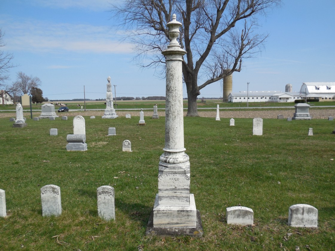
Hoovers Corners (Hardscrabble) – Ballville Township
Location: 41.263752, -83.131161
on Tiffin Rd at the intersection of Deran Rd along Indian Creek
Remnants: Decker (Hoover) (Hardscrabble) Cemetery on the west side of Tiffin Rd just north of the intersection
Description: This small farming town was founded by German immigrants Lawrence Hoover (1807 – 1882) and Mary Hoover (1811 – 1889) who were early pioneers in the county and owned a 100-acre farm on the west side of the intersection. They were buried in the cemetery with 3 of their children named Henry, Mary, and Lawrence who all passed away at young ages. The cemetery was established on the northern end of the Hoover farm. A church in the southeast corner of the intersection was built in the mid-1850s and there was a school on the north side of E Deran Rd just east of Indian Creek (formerly Sugar Creek). They were both pinpointed in the 1874 county atlas. The Decker family was the most prominent in the area in the mid to late 1800s, led by Benjamin Decker (1816 – 1901) and Elizabeth (Myers) Decker (1823 – 1889) who moved to Ohio from Pennsylvania and had several children. They were also laid to rest with relatives in the cemetery. It’s unknown when the area went by Hardscrabble, which was a common locality name in the 1800s. The term referred to the hardships of farming land that was tough to cultivate and the economic struggles which went along with it.
Ransoms – Townsend Township, Sandusky County and Margaretta Township, Erie County
Location: 41.386631, -82.845677
on Co Rd 247 and Vickery Rd at the intersection of Carson Pass (NW Rd) along Little Pickerel Creek
Remnants: none known
Description: The proprietors were Charles H. Ransom (1821 – 1901) from New London County, Connecticut and Susan (Slaughter) Ransom (1826 – 1917) from New York. They had 6 children and accumulated 764 acres of land in the area engaging in farming and stock dealing. A steam-powered saw mill and a grist mill were along Vickery Rd just west of the GPS coordinates in the mid to late 1800s. The Sandusky, Dayton, & Cincinnati, Railroad (later the Lake Erie & Western Railroad) rolled through the southeast corner of the Ransom farm in Margaretta Township. Charles and Susan were buried with relatives in Oakland Cemetery on US 250 (Milan Rd) in the City of Sandusky.
Teemes – Townsend Township
Post Office: 1891 – 1906
Location: 41.418744, -82.862951
on Teems Rd between US 6 (Chickasaw Trail) and Yetter Rd
Remnants: none known
Description: Teemes was a prosperous farming and postal town with a school. George A. Cowell (1862 – 1948) was the postmaster. He was buried with relatives 5 miles southeast of the GPS coordinates in Castalia Cemetery on Bardwell Rd in Castalia in Margaretta Township, Erie County.
Tousaint – Woodville Township
Location: 41.479458, -83.387556
on Rife Rd between Trapp Rd and Emch Rd along Toussaint Creek
Remnants: none known
Description: This small farming town sat on the Pennsylvania & Northwestern Railroad (formerly the Toledo, Tiffin, & Eastern Railroad).
York North Ridge – York Township
Post Office: 1833 – 1855
Location: 41.338424, -82.908846
on SR 101 between Mugg Rd and Wales Corners Rd
Description: As with York South Ridge (Exeter / Wales Corners) the town was named after the York family in the county and the massive glacial sand ridge it was on. It had a school on SR 101 near the GPS coordinates and a steam-powered saw mill in the southwest corner of the intersection of SR 101 and Wales Corners Rd. The postmasters were Josel Sizer, C. S. Shults, Samuel Sizer, George H. Jones, and C. S. Shults again took on the position until the office was discontinued.