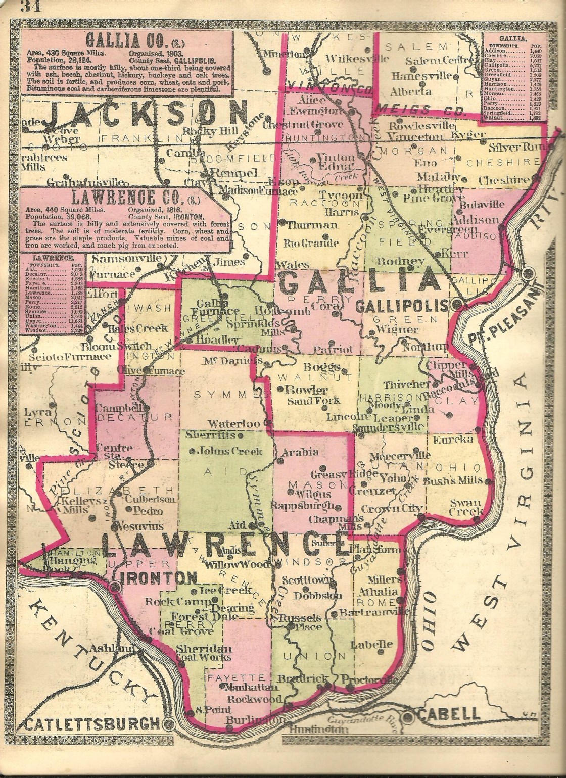
Cherryville – Aid Township
Post Office: 1890 – 1917
Location: 38.610883, -82.530982
on Sharp’s Creek Rd (Co Rd 19) between Martin Rd and Symmes Creek Rd along Sharps Creek
Remnants: former school on the north side of Sharp’s Creek Rd about a mile east of the GPS coordinates, old houses and farm buildings in the area
Description: Cherryville was a small farming town with a school. Residents were also employed in the local mining industry. John C. Martin (1851 – 1924) was the postmaster. He was buried with relatives about 8 miles southwest of town in Sugar Creek Cemetery on the north side of SR 141. Some other residents of Cherryville were buried in Aid Cemetery 3 miles east of the GPS coordinates at the intersection of SR 141 and Sharp’s Creek Rd.
Dean – Elizabeth Township
Location: 38.668266, -82.647441
on SR 373 (Texas Hollow Rd) between SR 93 and Dean Forest Rd
Remnants: none known
Description: The town was named after Lovead Dean (1820 – 1894) from Taunton, Massachusetts. It had a train station on the Iron Railroad (later bought by the Dayton & Ironton Railroad) and was home to coal mines owned by the Belfont Iron Works. Lovead was its vice president and the company operated a furnace in Ironton. The town also had a couple of stores and a school. Lovead Dean was buried with relatives in Woodland Cemetery on Carlton Davidson Ln in Ironton.
Ensee – Windsor Township
Post Office: 1890 – 1903
Location: 38.507318, -82.426885
on Greasy Ridge Rd (Co Rd 2) at the intersection of McKinney Creek – Slate Run Rd
Remnants: Cox Family Cemetery on the east side of Greasy Ridge Rd just south of the GPS coordinates, Pomaria Church and Cemetery on McKinney Creek – Slate Run Rd just northwest of the GPS coordinates
Description: Ensee was named after a type of apples modified from Rome Beauty seeds and were originally grown around 1880 by Nelson Cox (1828 – 1902) who moved to Lawrence County from Cable County, West Virginia. The word Ensee is derived from the pronunciation of his name’s initials. Nelson married Lydia (Gardner) Cox (1830 – 1918) and had at least 6 children. They purchased the orchard farm in 1854 from Lydia’s brother Roswell Gardner (1828 – 1912). Roswell contracted the “Western Fever”, which wasn’t a deadly illness, but simply the desire to move west seeking fortune and new opportunities as so many did during that era. He lived in Illinois for a while and later moved back east. Local residents laughed at the thought of Nelson and Lydia ever attaining success in the fruit industry. However, they expanded the orchard to 60 acres in 1860, mostly growing apples and a few other fruits. The harvests were abundant, and suddenly it seemed, the skeptical residents weren’t laughing about it anymore. Nelson and Lydia built a new house in 1870 and donated land and funds for the construction of Pomaria Church in 1871. There was also a school on the west side of Greasy Ridge Rd north of intersection of Slate Run Rd. One of the Cox’s sons, Elton G. Cox (1863 – 1921), was the town’s first postmaster and continued the family’s orchard business with his company called E. G. Cox Fine Fruits. Nelson and Lydia were buried with relatives in Cox Cemetery. Elton was buried with relatives in Rome – Proctorville Cemetery 7 1/2 miles southeast of the GPS coordinates on the northwest side of County Rd 411 in Rome.
Gold Camp (Goldcamp Station) – Elizabeth Township
Location: 38.646102, -82.739480
on SR 650 along Pine Creek between SR 522 (Superior – Lawrence Furnace Rd) and Little Pine Creek Rd (Co Rd 27)
Remnants: portions of the former railroad track bed, old houses and farm buildings in the area
Description: Gold Camp had a train station on the Detroit, Toledo, & Ironton Railroad. The land for the station was donated by Ferdinand H. Goldcamp (1837 – 1916) and Mary (Monnig) Goldcamp (1839 – 1916). They had 10 children and a nice farm of 143 acres. The 2nd generation established a hardware store chain called Goldcamp Brothers & Company and purchased a mill in 1887, renaming it the Goldcamp Milling Company. Both of those enterprises were based in Ironton. Henry I. Goldcamp (1873 – 1956) continued farming on the old family homestead. He married Margaret (Gallagher) Goldcamp (1879 – 1974) in 1898 and had 9 children. Ferdinand and Mary were laid to rest with over 60 relatives in Calvary Cemetery on the east side of Carlton Davidson Ln in Ironton.
Grant Town – Union Township
Location: 38.442088, -82.405923
on Old State Rte 7 at the intersection of Pvt Dr 1188 along the Ohio River
Remnants: none known
Description: It was an early pioneer settlement in section 26 of Union Township that couldn’t keep up with its nearby rival Quaker Bottom in section 25, which enjoyed continued success and eventually turned into Proctorville.
Ida – Windsor Township
Post Office: 1892 – 1908
Location: 38.566796, -82.426923
on Greasy Ridge Rd (Co Rd 2) between Capper Ridge Rd (Township Rd 228) and Venisonham – Greasy Ridge Rd (Township Rd 141)
Remnants: Perkins Ridge Baptist Church and Cemetery at the GPS coordinates, Perkins (Holderby) Cemetery on private property on the west side of Greasy Ridge Rd about 1/2 of a mile north of the GPS coordinates
Description: Ida had a school (Windsor Township No. 8) on the east side of Greasy Ridge Rd north of the GPS coordinates on land owned by Abner Holderby (1809 – 1895) from Cabell County, West Virginia and Elizabeth (Thompson) Holderby (1827 – 1915). Lauren Alonzo Gossett (1869 – 1947) was the only known postmaster. He married Carrie (Gillett) Gossett (1873 – 1956) in 1891 and had a few children. The ridge was named after the Perkins family who moved to Ohio from North Carolina in the early 1800s. Some members of the Perkins, Holderby, and Gossett families were laid to rest in Perkins Cemetery. Most of the town’s residents were buried in Perkins Ridge Cemetery.
Iron Rock – Hamilton Township
Location: 38.560103, -82.738265
on US 52 along the Ohio River between Rock Hollow Rd (Co Rd 128) and Happy Hollow
Remnants: none known
Description: Iron Rock was on the Scioto Valley Railway just west of Hanging Rock and was listed in the 1887 county atlas.
Israel – Perry Township
Post Office: late 1840s – 1860
Location: 38.503321, -82.583529
on SR 243 at the intersection of Deering Bald Knob Rd
Description: It was mentioned as a postal town in volume 1 of A Standard History of the Hanging Rock Iron Region of Ohio. Israel was also listed on page 53 in the 1868 Atlas of the State of Ohio in the northwest quarter of section 5 and stretching west into the northeast quarter of section 6. The location later turned into the town of Deering (Dearing) which had a post office from 1884 – 1907 and is still a populated place.
Jep
Post Office: 1900 – 1917
Location: unknown
Description: Edward Brohard (1869 – 1930) from West Virginia was the first postmaster. He was buried with relatives in Calvary Cemetery on Carlton Davidson Ln in Ironton.
Johns Creek – Aid Township
Post Office: 1887 – 1903
Location: 38.671416, -82.568770
on Etna – Waterloo Rd (Co Rd 4) along Johns Creek at the intersection of Johns Creek Rd (Township Hwy 94)
Remnants: old houses and farm buildings in the area
Description: It had a church and a school (Aid Township No. 4) on land donated by War of 1812 veteran Walter Neal Jr. (1786 – 1873) and Deborah (Arnot) Neal (1783 – 1843). They were from Bedford County, Virginia and moved to Harrison Township, Gallia County. Walter and Deborah also owned several hundreds of acres of land in Aid Township and passed most of it down to their children. Hugh McIntyre (1832 – 1920) was the town’s postmaster. He married a granddaughter of Walter and Deborah, Mary Jane (Neal) McIntyre (1840 – 1907), in 1862 and had 7 children. They were buried with relatives in Woodland Cemetery on Carlton Davidson Ln in Ironton. Walter and Deborah were buried with relatives in Landthorn Cemetery on private property in the woods east of Clay Lick Rd (Township Hwy 702) in Harrison Township, Gallia County.
Kennedys Cross Roads – Rome Township
Post Office: 1857 – 1863
Location: unknown
Description: It was founded by a branch of the Kennedy family in the county.
Kerrsville – Union Township
Location: 38.468822, -82.442620
on SR 243 along Symmes Creek between McKinney Creek Rd and Eaton Rd
Remnants: Kerr Cemetery on private property on the south side of SR 243 at the GPS coordinates about halfway between the road and Symmes Creek
Description: Kerrsville was listed in The Ohio Gazetteer, Or, Topographical Dictionary and The Ohio Gazetteer and Traveler’s Guide from 1829 – 1841 and contained around 10 – 12 houses. Although they didn’t found the town and it fell off of maps in the mid-1800s, William M. Kerr (1810 – 1891) from Pennsylvania and Caroline Kerr (1827 – 1885) were lifelong residents and its most prominent citizens. They owned a large farm, had several children, and were buried with some relatives and other townspeople in the cemetery.
Long Hollow – Decatur and Elizabeth Township
Location: 38.673263, -82.635952
on SR 373 (Dean Forest Rd) at the intersection of Texas Hollow Rd
Remnants: none known
Description: Long Hollow was along the Detroit, Toledo, & Ironton Railroad. The original proprietors were Hiram Campbell (1810 – 1896) from Kentucky and Sarah (Woodrow) Campbell (1815 – 1892) from Highland County. They had 4 children, owned half of Decatur Township, and held extensive interests in the county’s iron furnace, mining, and railroad industries. Hiram served in the state legislature and was a cousin of John Campbell (1808 – 1891) who founded Ironton in 1849. Long Hollow had around 20 residences, freight scales on the north side of Texas Hollow Rd, and a school on the west side of SR 373 north of the GPS coordinates. Hiram and Sarah were buried with relatives in Woodland Cemetery on Carlton Davidson Ln in Ironton. They lived in a 24 room mansion that was built in Ironton in 1850. It still stands at 321 N 5th St.
Manker (Mancker) – Lawrence Township
Post Office: 1897 – 1917
Location: 38.589227, -82.512792
on SR 141 at the intersection of De Loss Creek Rd (Co Rd 116)
Remnants: none known
Description:
William S. Mays (1868 – 1917) was the postmaster. The office name changed from Mancker to Manker in 1898 and was discontinued when William passed away. He was buried with relatives 7 miles southeast of town in Mays Cemetery in the woods on the east side of Neds Fork Rd (Co Rd 53).
Montreal – Fayette Township
Post Office: 1894 – 1907
Location: 38.437273, -82.541172
on Solida Rd at the intersection of Pvt Drive 2396 along Solida Creek
Remnants: former general store on the east side of Solida Rd at the GPS coordinates, old houses and farm buildings in the area
Description: The former general store is now a private residence. It was constructed in 1880 and was owned by Willard F. Moore (1858 – 1933) and Mary Ann (Faverty) Moore (1868 – 1960). They got married in 1887 and their store made it into the county atlas later that year. Louis A. McKee (1857 – 1944) was the postmaster. He was buried with relatives a mile south of the GPS Coordinates in McKee Cemetery #2 in the woods on the east side of Pvt Rd 1543. Willard and Mary Ann were buried with relatives in Woodland Cemetery on Carlton Davidson Ln in Ironton.
Moulton – Decatur Township
Location: 38.717599, -82.632061
on SR 93 at the intersection of Waterloo – Mt Vernon Rd along Pine Creek
Remnants: none known
Description: The proprietors were John Henry Moulton (1843 – 1910) and Maria (Campbell) Moulton (1845 – 1921). John was an ironmaster and established the Sheridan Coal Works in 1867. Maria was a daughter of the pioneer industrial moguls Hiram and Sarah Campbell. They married in 1869 and had 6 children. John also worked with his father-in-law and Maria’s brothers in iron manufacturing. The town was on the Detroit, Toledo, & Ironton Railroad. John and Maria were buried with relatives in Woodland Cemetery on Carlton Davidson Ln in Ironton.
Sedgewick (Sedgwick) – Upper Township
Location: 38.551147, -82.702258
on McPherson Ave at the intersection of Thomas St in Ironton
Remnants: Sedgwick United Methodist Church on the north side of Reynolds St southwest of the GPS coordinates
Description: It was listed in the 1887 county atlas as a separate town and was eventually annexed into Ironton. The church was constructed in 1907.
Strobel – Upper Township
Post Office: 1903 – 1912
Location: 38.548702, -82.616186
on SR 141 along Sugar Creek at the intersection of Branch Sugar Creek Rd
Remnants: none known
Description: Strobel was a small postal town just east of Hecla. Charles P. Stanley (1858 – 1955) was the postmaster. He was buried with relatives in Sugar Creek Cemetery west of the GPS coordinates at the intersection of SR 141 and County Rd 44 S.
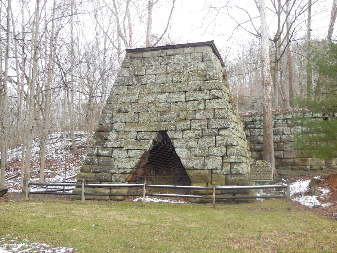
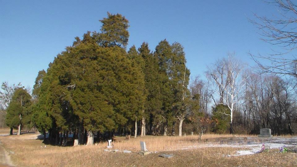
Vesuvius (Vesuvius Furnace) – Elizabeth Township
Post Office: 1883 – 1902
Location: 38.605014, -82.630379
on Ellisonville – Paddle Creek Rd (Co Rd 29) at the intersection of Sugar Creek Ridge – Vesuvius Rd N along Storms Creek on the south side of Lake Vesuvius
Remnants: Vesuvius Furnace and historical marker on the northeast side of the GPS coordinates, Vesuvius Cemetery in the woods on the north side of Ellisonville – Paddle Creek Rd between the Main Loop Trail and the furnace
Description: Named after the Italian volcano, the first furnace at Vesuvius was built in 1833 by Samuel Gould, John Hurd, and Joseph Smith. It was cold blast, meaning the air wasn’t heated before entering. The owners decided to try building a hot blast furnace, which was a relatively new concept at the time. Construction on the second furnace began in 1836 and it successfully became the first hot blast furnace in the country, employing a couple hundred residents in various industries related to the iron production. The town was on the Iron Railroad and had the usual amenities of a furnace community including a company store, school, grocery store, and a blacksmith shop. The furnace changed ownership several times over the passing decades. One of the owners, Joseph Work Dempsey (1818 – 1852), was tragically killed in an accident at the furnace when the scaffolding he was on collapsed. The furnace continued to operate until taking its last breath in 1905 and closing the following year. Lake Vesuvius was constructed in the early 1930s to create a local recreational destination. The accompanying park offers many outdoor activities and is an ideal place for a picnic. Vesuvius Furnace was added to the National Register of Historic Places in 1990 and has had the benefit of some preservation efforts. Its original large retaining wall is a sight not found at the other furnace sites around the state. Joseph Dempsey was buried with relatives in Woodland Cemetery on Carlton Davidson Ln in Ironton. About 100 of the town’s residents were buried in Vesuvius Cemetery.
Whitehouse – Windsor Township
Location: unknown
Description: It was in section 17 of Windsor Township.
Windsor Cross Roads (Windsor X Roads)
Post Office: 1840 – 1850
Location: unknown
Description: William G. Robinson (1830 – 1869) was the postmaster. He was buried with relatives in Rome – Proctorville Cemetery on the northwest side of County Rd 411 in Rome.
Blackfork, OH – (1818 – present farming, clay mining, and brickyard town nearly abandoned and later repopulated)
Classification: small town
Location: Jefferson Township, Jackson County and Washington Township, Lawrence County – On SR 93 at the intersection of Blackfork Rd
The town was settled next to Black Fork Creek by a mix of runaway slaves from the south, native Americans, and European immigrants. They were all paid the same wages by local businesses during a time when racial prejudices were still running rampant in most of the rest of the country. The Union Baptist Church was organized in 1819. It was originally a log cabin structure but was replaced in the late 1800’s.
Blackfork’s first biggest sources of income were the Blackfork Coal Co. and its iron furnaces. Washington Furnace was built in the early 1850s. It was in operation from 1853 until the late 1800s and what’s left of it can be found in the woods off a gravel road on the south side of the intersection of Blackfork – Firebrick Rd and Irish Hollow Rd. The other furnace called Cambria was built in 1854. Its remains are inaccessible on private property. The land where the coal mines were got sold to the Cambria Clay Products Company who dealt in clay mining and had a brick making plant. The brickyard also had a freight station on the Toledo, Cincinnati, & St. Louis Railroad.
Portions of the old railroad platforms remain in the area and the railroad’s tunnel # 2, constructed in 1882, is about 4 miles south of town under an overpass on Dry Ridge Rd. It was constructed by the residents of Blackfork. The railroad was later bought out by the Cincinnati, Hamilton, & Dayton Railroad, and then sold to the B&O who reconstructed the tunnel in 1916. That line of tracks was abandoned the following year. It was replaced by the Detroit, Toledo, & Ironton Railroad which was in operation from 1905 – 1983. Henry Ford bought it in 1920 and had new tracks built that ran through town for hauling pig iron to Detroit.
Many resident left to find work in other town when the brick company went out of business in the early 1960s and trains ceased operations in the early 1970s. The foundation of the Cambria Company general store is still visible and marked by a set of steps next to Blackfork – Firebrick Rd. Residents were buried several cemeteries including Washington Furnace Cemetery further south down the gravel road past the furnace, Union Baptist Church Cemetery on Ninner Hill, and Bethel Cemetery on Gallia – Blackfork Rd. The town’s post office ran from 1902 – 1985.
Thanks to Donna Dickerson for providing info on the more modern railroad in Blackfork! We previously only had info on the town’s early tracks. Her dad knew most of the Detrot, Toledo, & Ironton engineers and firemen and occasionally took her with him to check it out. The trains also did pick-ups from the plant at Pedro and would ride up to the clay mill to drop entity cars and take the full cars away.

Olive Furnace, OH (Mount Olive) – (1846 – 1915 iron furnace and farming town mostly abandoned after the furnace operation stopped)
Classification: semi-ghost town
Location: Washington Township, Lawrence County – On SR 93 1/2 of a mile north of Kimble Creek Rd
Olive Furnace was built next to Olive Creek in 1846 and was financed by John Peters, John Campbell (the founder of Ironton, OH), Madison Cole, William Clements, and J. L. Thompson. The furnace provided iron for steel manufacturing during the Civil War and for steel manufacturers in Northern Ohio and other places around the country.
The furnace, coal mines, and the surrounding town (sometimes called Mount Olive) were on 3,600 acres of land that was purchased by the furnace owners. Most of the early roads in the township were built and maintained by the furnace company. Beside the buildings at the furnace, the town also had a blacksmith shop, carpenter shop, company store, church, and a school, as well as a few dozen houses for the workers. The closest railroad station was about 1/2 of a mile southwest of town on the Cincinnati, Hamilton, & Dayton Railroad. The furnace began operation in 1847 and produced an average of nearly 4,000 tons of iron every year until production stopped in 1910. Farming was also a local source of income.
In 1915 the furnace was sold for scrap iron and a lot of it was destroyed. The Olive Furnace post office ran from 1857 – 1915. Now the land is owned by the Mt. Olive Furnace Park Corporation which is accepting donations with plans to reconstruct the furnace. The Mount Olive Community Baptist Church still stands across the road from the remains of the furnace and Olive Furnace Cemetery is up a hill behind the furnace.