
Baddow Pass (Baddaw Pass) (Summit) – Richland Township
Post Office: 1892 – 1894
Location: 40.494508, -82.147932
on Township Highway 14 along the Holmes County Trail between Baddow Pass Rd (County Highway 75) and Township Highway 32
Remnants: none known
It was on the Cleveland, Akron, & Columbus Railroad but didn’t have a train station, and was named after the cut in the terrain for accommodating the track bed. The closest school was a mile southwest of the GPS coordinates in the southwest corner of the intersection of Township Rd 12 and Township Rd 4 on land donated by Jonathan and Mary (Shocknesse) House. The former track bed is currently part of the Holmes County Trail, a 22-mile paved recreational path.
Holmes County Trail Info – https://www.ohiobikeways.net/holmes.htm
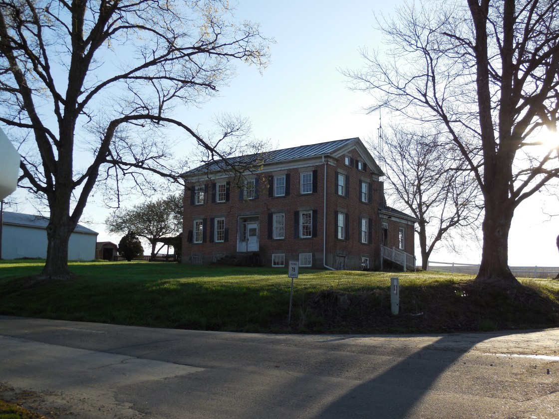
Charlesburg – Washington Township
Location: 40.646194, -82.114741
on Township Highway 472 near the intersection of Township Highway 474
Remnants: Lakeville (Shoup) Cemetery on the south side of Township Rd 472 about 1/2 of a mile west of the GPS coordinates
Description: It was a small farming town with no other major industries.
DeWitt Ridge (Dewitts Ridge) – Richland Township
Post Office: 1861 – 1868
Location: 40.521537, -82.145880
on SR 520 at the 3 way intersection with County Highway 75 and Township Highway 16
Remnants: Dewitts Ridge Cemetery near the GPS coordinates
Description: James H. DeWitt (1829 – 1891) and Elizabeth J. DeWitt (1838 – 1911) owned a grocery store with post office in the northeast corner of the intersection and James was the town’s postmaster. There was also a school on the south side of SR 520 about a mile east of the GPS coordinates on land donated by William Jones (1800 – 1878) from Virginia and Rebecca (Skeeles) Jones (1806 – 1883) from Maryland. The DeWitt and Jones families were buried in Christian Church Cemetery 3 miles east of the GPS coordinates at the corner of Main St and Depot St (SR 520) in Glenmont. After the post office closed, Richard M. Johnson (1832 – 1920) and Margaret (Phillips) Johnson (1842 – 1908) owned a blacksmith shop on the south side of the GPS coordinates. They were laid to rest in Sunnyside Cemetery about 3 3/4 miles east of town on the north side of SR 520. There is a DeWitts Ridge Cemetery listed on Find A Grave with no directions. Its only known interment is Susan (DeWitt) Morrison (1837 – ?).
Grade – Mechanic Township
Post Office: 1890 – 1901
Location: 40.507564, -81.888473
on County Highway 58 at the intersection of County Highway 580
Remnants: none known
Description: Grade didn’t have any big businesses, but the post office and a few small shops were enough to put it on maps back in the day. John L. Fleming (1836 – 1896) and Sarah (Leavengood) Fleming (1839 – 1914) owned a shoe shop in the northeast corner of the intersection and John was the town’s postmaster. In the 1800s, shoe shops were often operated by husband and wife teams with the work they did being paid for either in cash or fair trade bartering, including the completing of chores. After John passed away, their son Curtis B. Fleming (1869 – 1943) took on the postmaster position. He later moved to Coshocton County and was buried there with relatives in South Lawn Cemetery on Plum St in Coshocton. John and Sarah were laid to rest in Elliott Cemetery about 3 miles south of the GPS coordinates on the west side of Township Rd 112. The family surname was also spelled Flemming in some records.
Huston – Prairie Township
Location: 40.607838, -81.917642
on Township Rd 346 at the former railroad crossing between SR 83 and Township Rd 559
Remnants: none known
Description: It was named after a branch of the Huston family in the county and was on the B&O Railroad and the Cleveland, Akron, & Columbus Railroad.
Johnville – Washington Township
Location: unknown
Description: none found
Jones Corners – Richland Township
Post Office: 1861 – 1890
Location: 40.476635, -82.128970
on County Rd 25 at the intersection of Township Highway 13 and County Highway 75
Remnants: former Jones farmhouse in the northeast corner of the intersection, Union Grove Church and Cemetery about 3/4 of a mile east of the GPS coordinates on Township Highway 2 off of County Highway 25, other old houses and farm buildings in the area
Description: It was founded by William Jones (1787 – 1848) from Massachusetts and Rebecca Jones (1786 – 1868) from Pennsylvania. They had several children, accumulated a 640-acre farm, and donated land for a school in the southwest corner of the intersection of County Rd 25 and Township Hwy 26. According to the county auditor’s website, the brick farmhouse they owned was constructed in 1820 and is currently listed as being in fair condition. William White (1815 – 1888) from Berkshire County, Massachusetts may have somehow been related to the family. He was the town’s postmaster for the vast majority of the office’s existence and either inherited or purchased the Jones estate. Everyone mentioned in this listing was buried in Union Grove Cemetery.
Lafayette – Prairie Township
Location: 40.629931, -81.923950
on Main St at the intersection of SR 83 on the west side of Holmesville
Description: Lafayette is a ghost town due to a post office name change and expansion. It was platted in 1836, but there was already a post office with the same name in Ohio, so it went with Holmesville in 1837. Lafayette ended up being overtaken by the growing eastern side of town and was annexed into Holmesville in 1848. It continued to be the main business district until around 1870.
Mount Union (Union Village) (Zachstown) – Mechanic Township
Location: 40.453342, -81.901344
on SR 83 at the 3-way intersection of County Hwy 150 and Co Rd 19 at the confluence of Doughty Creek and Bucks Run
Remnants: none known
Description: Originally called Zachstown, its first cartographic appearance was listed as Union Village in the 1875 county atlas on a 154-acre farm owned by Robert Long (1809 – 1888) and Frances R. Long (1823 – 1899) from Pennsylvania. The village had a small plat on the east side of the GPS coordinates and a school in the northwest lot of the intersection on the west side of Bucks Run. Its name changed again by 1906 and was listed as Mt. Union in the 1907 county atlas. Robert and Francis were buried with relatives in Oak Hill (Millersburg Oak Hill) Cemetery 3 1/2 miles east of the GPS coordinates on the south side of Co Hwy 59.
New Wheeling – Knox Township
Location: 40.584611, -82.191286
on County Highway 23 along the Mohican River at the intersection of Township Highway 211
Remnants: none known
Description: none found
Portersfield – Monroe Township
Location: unknown
Description: The town was listed in The Ohio Gazetteer and Traveler’s Guide from 1837 – 1841. It’s unknown if any of the lots ever sold and Portersfield didn’t make it onto the 1861 county map.
Wardsville (Wards) – Clark Township (formerly German Township)
Post Office: 1828 – 1836
Location: unknown
Description: As we have seen in other places around the state, the process of natural selection also applies to towns. Jesse Ward platted Wardsville in the early to mid-1820s near the southern border of Clark Township. He was also the town’s postmaster. New Bedford was quickly platted afterwards in 1825 just across the border in Crawford Township, Coshocton County as Wardsville’s rival. It won the contest for population growth and local businesses, leaving Wardsville in the dust.
Wilmington
Location: unknown
Description: Wilmington was platted with 61 lots in 1815 on the west side of Killbuck Creek as the first village in the county. The spot had been chosen in anticipation of a proposed canal route through the area, but that ended up going toward Holmesville. The idea of Wilmington, which hadn’t made much progress anyway, was abandoned.

Holmes County, Ohio Ghost Towns Research Resources
1861 – Holmes County map
1875 – Holmes County atlas
1907 – Holmes County atlas
