
Blackburn – Perry Township
Location: 39.542447, -82.638008
on Jack Run Rd (Co Rd 138) at the former intersection of Carroll Rd (Township Hwy 149)
Remnants: Morgan Chapel and Cemetery 1 mile north of the GPS coordinates on Jack Run Rd
Description: It was named after the Blackburn family in the county. The town had a school north of the GPS coordinates on the east side of Jack Run Rd at the intersection of Clapper Hollow Rd. Residents were buried in Morgan Chapel Cemetery.
Brashears – Ward Township
Post Office: 1886 – 1893
Location: unknown
Description: This small town was on the Monday Creek Branch of the Hocking Valley Railway in eastern Ward Township and had mines operated by the Consolidated Coal and Mining Company. Several men perished over the years from falling shelves and stones while working in the shafts. M. E. Schaffer was the postmaster.
Brush (Brush Fork Junction) – Ward Township
Location: 39.496997, -82.167021
on SR 78 at the intersection of Jobs New Pittsburg Rd along Brush Fork and Snow Fork
Remnants: none known
Description: The town was on the Brush Fork Branch of the Hocking Valley Railway. It had a general store on the west side of SR 78 south of the GPS coordinates owned by the Trimmer family and a school on the east side of SR 78 south of the store.
Cedar Falls – Benton Township
Location: 39.419620, -82.523167
on SR 374 at the intersection of Ilesboro Rd
Remnants: a park at the falls on the west side of SR 374 south of the GPS coordinates, 2 old stone bridges on SR 374 south of the GPS coordinates
Description: Cedar Falls was the site of a saw mill in the late 1800s and had a school. Its impressive waterfall now sits in Hocking Hills State Park along Ohio’s 1300 mile long Buckeye Trail. For anyone who enjoys less rustic accommodations than what camping offers, the Inn and Spa at Cedar Falls north of the GPS coordinates on SR 374 is another option.
Inn And Spa Info – https://innatcedarfalls.com/
Consol – Ward Township
Post Office: 1893 – 1898
Location: 39.507418, -82.189652
on Jobs – New Pittsburg Rd at the former intersection of Monday Jobs Rd along Brush Fork
Remnants: none known
Description: Consol was a small postal town between Jobs and New Pittsburg. It was the site of New Pittsburg Mine No. 3 and had a train station on the Brush Fork Branch of the Hocking Valley Railway. W. H. H. Wolfe was the only known postmaster.
Dewey Junction
Location: unknown
Description: This small town had a train station on the Hocking Valley Railway and mines operated by the Davis Coal Company.
Happy Hollow – Salt Creek Township
Location: 39.457315, -82.689865
on Happy Hollow Rd between SR 56 and Thompson Ridge Rd (Co Hwy 36)
Remnants: none known
Description: This former mining town is reportedly haunted by the ghost of a middle-aged man who appears to be in wet clothing and had been spotted along the road, on porches, and inside some local homes.
Hopperville – Green Township
Location: 39.480121, -82.295706
on Company Rd (T-336) north of US 33
Remnants: none known
Description: It was the site of a coal hopper owned by Peter Hayden (1806 – 1888) from New York, who founded Haydenville. The town was on a railroad switch off of the Hocking Valley Railway running along Company Rd. It also had a steam-powered saw mill and a small quarry west of the GPS coordinates and a coal works northwest of the GPS coordinates. Peter was buried with relatives in Green Lawn Cemetery on Greenlawn Ave in Columbus.
Joe – Marion Township
Post Office: 1887 – 1903
Location: 39.647527, -82.407708
on Bremen Rd at the intersection of Schmeltzer Rd (Township Hwy 91) along Rush Creek
Remnants: old houses and farm buildings in the area
Description: Philip Heyd operated a grist mill in the lot south of the GPS coordinates. William Sholl (b. 1842) was the postmaster.
Kachelmacher (Greendale) – Green and Ward Township
Post Office: 1879 – 1939
Location: 39.536750, -82.277815
on SR 595 at the intersection of Dawley Rd along Monday Creek
Remnants: Dawley – Downhour Cemetery east of the GPS coordinates on Shields Rd south of the intersection of Jacobs Rd, former brick plant remains along SR 595, former school next to SR 595, old houses and farm buildings in the area
Description: In the area’s early days, there was a saw mill on the south side of Dawley Rd on the east side Monday Creek on land owned by the Wolf family and a school on the south side of Jacobs Rd east of the cemetery. Dawley – Downhour Cemetery was established on land owned by Nathan Dawley (1793 – 1873) and Anna (Wilcox) Dawley (1802 – 1883). They moved to Ohio from Rhode Island, were pioneers in the county, and had 11 children. Although the cemetery isn’t extremely far from SR 595, the location is still rather remote, but it is well-maintained. Oil, coal, and iron tycoon, Nils Kachelmacher (1860 – 1917) from Norway, directed the construction of the Greendale Brick Plant along SR 595. It ran from 1907 to the mid-1930s. At a cost of $1 million, it was said to be the largest in the world. The plant supplied much of the country’s bricks until The Great Depression hit the economy and led to the company’s demise. There was also a company general store and a school constructed for the workers and their children. The school still stands next to SR 595 near what’s left of the formerly massive brick plant compound. Nils was never married and was laid to rest in Kachelmacher Mausoleum in Kachelmacher Park south of US 33 on Falls St in Logan. There’s a historical marker in the park with more info about him and the brick plant. Greendale is still a populated place, but there’s far less residents in the area these days. The post office on the railroad was called Kachelmacher from 1906 – 1910.
Lost Run – Ward Township
Location: 39.554322, -82.231860
on Brady Rd (Buckeye Trail) along Lost Run between James Rd and SR 216
Remnants: none known
Description: According to Henry Howe’s Historical Collections Of Ohio, the creek was named after the story of a pioneer hunter who got lost and froze to death there in the early 1800s. His skeleton was found years later with a rifle laying next to it.
Max – Marion Township
Post Office: 1899 – 1903
Location: 39.634055, -82.389596
on Harvey Chapel Rd at the intersection of Dewey Rd
Remnants: South Harvey Chapel and Cemetery on the west side of Harvey Chapel Rd about 1/2 of a mile north of the GPS coordinates, old houses and farm buildings in the area
Description: This small farming and postal town had a blacksmith shop on the north side of Maxville Rd near the intersection of Saunders Rd and a school west of South Harvey Chapel on a now abandoned stretch of road on land owned by the Larimer family. Samuel Focht (1854 – 1916) was the postmaster. He was buried with relatives in the cemetery. The church and cemetery were constructed on land owned by Benjamin Poling (1815 – 1895) and Elizabeth (Short) Poling (1817 – 1908). Benjamin’s parents, War of 1812 veteran Samuel Poling (1793 – 1866) from Maryland and Elizabeth (Stemem) Poling (1795 – 1882) from Virginia, moved to Ohio in 1829 and had 12 children. They donated the majority of funds for construction of the original log Harvey Chapel on the east side of Rush Creek. It was replaced with a wood frame structure in 1856, and later the present church. Thanks go to Beverley Poling for providing some of the info on Max! Her late husband’s great-grandfather was Peter Poling (1813 – 1907), who owned the land across the road from the church.
Nancy – Salt Creek Township
Post Office: 1892 – 1909
Location: 39.390211, -82.659126
on Blue Creek Rd at the intersection of Vandergriff Rd (Township Hwy 185)
Remnants: Schooley Cemetery at the GPS coordinates, old houses and farm buildings in the area
Description: Nancy had a school on the east side of Blue Creek Rd north of the GPS coordinates and a church on the northwest side of Blue Creek Rd south of the GPS coordinates. William Parks (1849 – 1938) was the postmaster. He married Sarah (Swackhammer) Parks and later moved to Circleville in Pickaway County where they were buried in Forest Cemetery on N Court St (Co Rd 511). They both have relatives buried in Schooley Cemetery.
Needmore – Marion Township
Post Office: 1892 – 1902
Location: 39.622766, -82.394158
on Bear Run Rd at the intersection of Harvey Chapel Rd
Remnants: none known
Description: W. F. Rittgers (1857 – 1930) was a Freemason and the town’s postmaster. He was buried with relatives about 7 miles south of the GPS coordinates in Oak Grove Cemetery on Jennison Ave in Logan.
New Pittsburg (New Pittsburgh) – Ward Township
Location: 39.514617, -82.195388
on Jobs – New Pittsburg Rd at the intersection of Dawley – New Pittsburg Rd along Brush Fork
Remnants: none known
Description: As with Jobs, New Pittsburg was a company owned coal mining town and also had a train station on the Brush Fork branch of the Hocking Valley Railway. The town’s miners set a new world record for coal production with 3,333 tons in 168 cars while working an 11-hour day in April of 1892. The record was broken just a month later by the miners of Jobs who did theirs in less than 8 hours.
Pattonsville – Green Township
Post Office: 1847 – 1857
Location: unknown
Description: It was in section 13 of Green Township and was founded by Robert Patton (1779 – 1865) and Mary (Halterman) Patton (1789 – 1828). They built a saw mill in 1825 that was probably the first in the township. Robert remarried after Mary passed away and added a grist mill to the site around 1832. The mill dam was washed away in a flood in 1860 and was never rebuilt. Robert was buried with relatives in Oak Grove Cemetery on Jennison Ave in Logan. Members of the same family also founded Pattonsville in Jackson county, which is still a populated place.
Pine Grove – Good Hope Township
Location: 39.597339, -82.553510
on Clear Creek Rd (Co Rd 116) along Clear Creek between US 33 and Starner Rd
Remnants: none known
Description: Pine Grove had a grist mill and saw mill next to Clear Creek owned by John Arney (1805 – 1876) from Fairfield County and Johanna (Klinker) Arney (1805 – 1867) from Germany. They had several children, over 300 acres of farmland on 3 lots, and donated land for the Hocking Valley Railway tracks on the east side of the Hocking River. John and Johanna were buried with relatives in Elmwood Cemetery 9 miles north of town on S Mt Pleasant Ave in Lancaster, Fairfield County.
Point Pleasant – Washington and Benton Township
Post Office: dates not listed
Location: 39.437196, -82.509097
on Kalklosch Rd (Township Hwy 271) at the intersection of Cotterman Rd (Township Hwy 246)
Remnants: none known
Description: Mary (Strawn) Hone (1823 – 1918) from Perry County was the town’s founder and proprietor. She platted Point Pleasant in the southwest corner of her 180 farm after her husband, Civil War veteran James Hone (1822 – 1864) from Morgan County, passed away. It had a post office and a blacksmith shop, but only attracted a few families over the years and eventually reverted back to farmland. Mary and James had several children and were buried with relatives about 4 miles south of the GPS coordinates in Fairview Church Cemetery on the south side of Fairview Ridge Rd (Co Rd 287).
Pursell (Purcell) – Benton Township
Post Office: 1892 – 1905
Location: 39.440466, -82.599782
on Big Pine Rd (Co Rd 11) at the intersection of Webster Rd along Pine Run
Remnants: none known
Description: Pursell had a saw mill next to Pine Creek and a school on the west side of Webster Rd. They were both on land owned by the Dresback family. Most of the Dresbacks, and the town’s last postmaster Francis Lindsey (1866 – 1950), were buried in Pine Grove Cemetery 2 miles northeast of the GPS coordinates at the intersection of Big Pine Rd and SR 374.
Reeds – Salt Creek Township
Location: 39.413278, -82.643194
on SR 56 at the intersection of Narrows Rd along Salt Creek
Remnants: none known
Description: It was founded by a branch of the Reed family in the county.
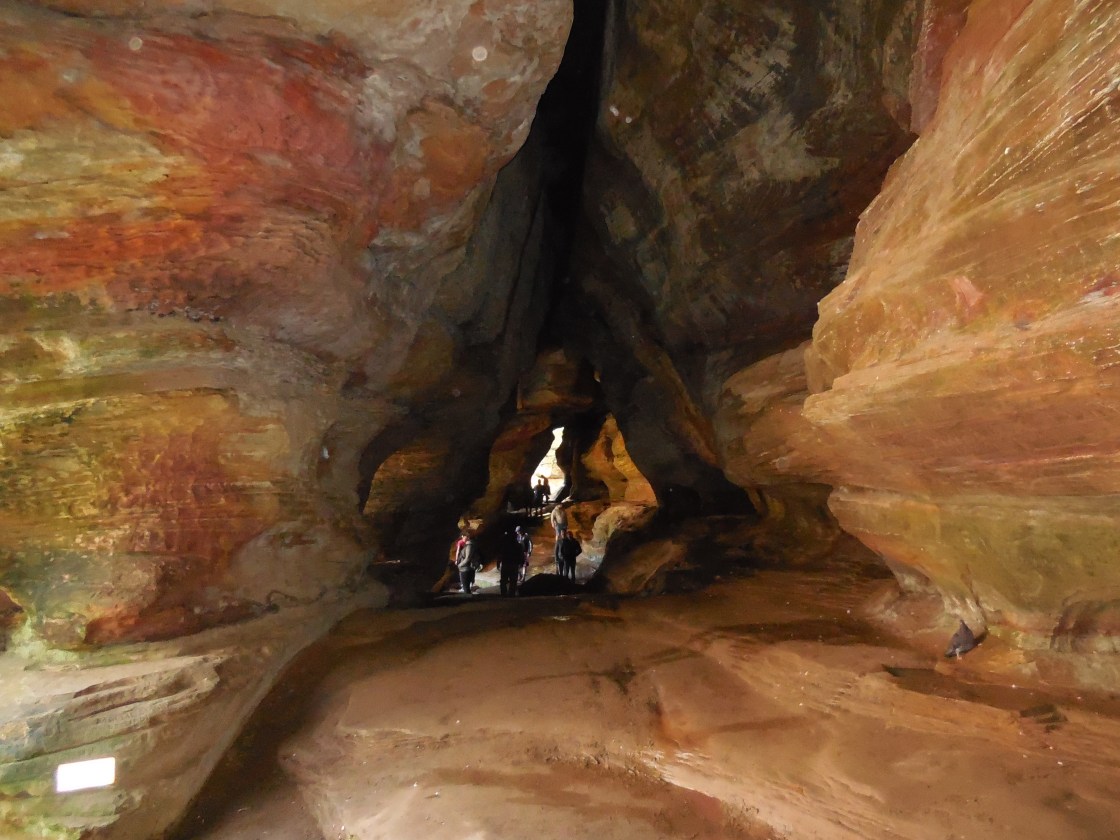
Rockhouse (Rock House) – Laurel and Perry Township
Post Office: 1844 – 1907
Location: 39.494385, -82.614464
on SR 374 at the intersection of Thompson Ridge Rd (Co Rd 36)
Remnants: Rock House Park on the north side of SR 374
Description: The town was named after the cave that now sits in Hocking Hills State Park. As with many caves in Ohio, it was originally inhabited by Native Americans and was later occupied by thieves and bandits who were hiding from justice during the early years of Ohio’s statehood. They disappeared as the area became more settled and the cave acquired more honest visitors. A saw mill and grist mill next to Laurel Run along SR 374 were owned by William Loomis (1841 – 1918) and Nancy Loomis (1840 – 1915). They moved to Columbus where they were buried with relatives in Green Lawn Cemetery on Greenlawn Ave. Businessman and Civil War veteran Lieutenant Colonel Ferdinand Frederick Rempel (1824 – 1901) from Prussia, Germany constructed a lavish 16-room hotel with a ballroom, post office, and livery stable at Rock House in 1878. He added some cabins and turned it into a popular summertime resort. The hotel fell into disrepair and was sold to the state by Colonel Rempel’s heirs in 1925. Ferdinand Rempel was buried with relatives in Oak Grove Cemetery on Jennison Ave in Logan.
Smock – Washington Township
Post Office: 1891 – 1904
Location: 39.408602, -82.494682
on Hoskins Rd between Fairview Ridge Rd (Co Rd 287) and Ilesboro Rd
Remnants: none known
Description: It was named after the family of Nancy (Kimple) Smock (1816 – 1905) from New Jersey. She moved to Ohio from with her husband Philip Smock (d. 1863) and was a pioneer in the county. Nancy also owned the land where the post office was. The town had a school on the east side of Hoskins Rd just north of the GPS coordinates on land owned by the Call family. Nancy was buried with relatives in Oak Grove Cemetery on Jennison Ave in Logan. Sanyek Reichley (1830 – 1907) was the first postmaster and was buried with relatives in Fairview Church Cemetery a mile southeast of the GPS coordinates on the south side of Fairview Ridge Rd. Mattie P. Engle (1860 – 1910) was the last postmaster.
South Carbon Hill – Ward Township
Location: 39.493225, -82.249731
on SR 278 between Coe Hollow Fruitdale Rd (Township Hwy 345) and Loop Rd (Township Hwy 387B)
Remnants: none known
Description: South Carbon Hill had a plat with a single row of lots lining the west side of SR 278 between Coe Hollow Fruitdale Rd and Monkey Hollow Rd. There was a school on land owned by Civil War veteran David Randolph (1825 – 1891) on the west side of SR 278 south of the GPS coordinates. It appears that the lots didn’t sell well and the idea of creating a bustling community was subsequently abandoned. The plat can be spotted in the 1876 county atlas. David is incorrectly listed as B. O. Randolph on the Ward Township map, but is correctly listed on page #31 with the plats of South Carbon Hill, Murray City, and Carbon Hill. He was buried with relatives in Carbon Hill Cemetery on the north side of Carbon Hill Buchtel Rd about a mile northeast of the GPS coordinates.
Summit (Summit Siding) – Starr Township
Location: unknown
Description: It was along SR 328 and the Hocking Valley Railway about halfway between Starr and Union Furnace with a passing siding for loading and unloading. The town was listed on the Ohio map in the 1901 George Cram atlas and several obscure railroad guides from the late 1800s to early 1900s.
Winona (Winona Furnace)
Post Office: 1877 – 1900
Location: 39.592140, -82.338847
on SR 93 at the intersection of SR 668 along Little Monday Creek
Remnants: Webb Chapel Cemetery northwest of the GPS coordinates at the end of St Clair Rd off of SR 312
Description: Winona Furnace was constructed by the Winona Iron Company and started blasting iron ore in 1878. It was sold to the Columbus and Hocking Iron and Coal Company in 1883. The town had a train station on the Straitsville Branch of the Hocking Valley Railway, a school, company general store, and 22 houses for the workers and their families. That small number provided shelter for around 150 residents while the furnace was in operation. Some of them were buried in Webb Chapel Cemetery.
Apple, OH (mid-1800s – present farming town)
Classification: small town
Location: Salt Creek Township, Hocking County – Near the intersection of Lively Rd and Pole Ridge Rd
There isn’t much info online about Apple and we suspect the reason is that quite simply nothing extraordinary good or bad has ever really happened there. It seems to be a relatively peaceful place to live. It was named for the abundance of apple orchards in the area in the mid-1800s. A cemetery was established in the early 1850s on Pleasant Ridge Rd north of the center of town and the Zion Church congregation organized in 1855 across the street.
The church building was constructed in the late 1850s. It’s been closed for several years now. The town also had a grocery store in the 1870s on Andrew Poling’s (1814 – 1887) farm, the former site of the post office, and was operated by one of his sons. Apple’s population probably peaked in the 1880s with about 100 residents and the post office ran from 1891 – 1911. There’s an abandoned house with a few outbuildings behind the church and a couple more in the woods around town.
Haydenville, OH (1852 – present mining and company store town, the last company town in Ohio)
Classification: small town
Location: Green Township, Hocking County – On Haydenville Rd off of US 33
Peter Hayden (1806 – 1888) was a businessman from New York who moved to Columbus. He immediately set out to build his fortune in Ohio with the booming industries of the mid-1800s. Peter founded the town of Haydenville in 1852 with big plans for its future. He had an iron furnace moved from Hanging Rock, OH by canal to Haydenville in 1856. The Haydenville Railroad Tunnel was also built that same year and is said to be haunted by some of the workers who died during its construction. It can be found on a trail that goes north out of the cemetery on Howard Rd. Unfortunately a collapse inside the tunnel has rendered it unsafe to explore.
The Hocking Canal provided easy access into town, but when Haydenville got a train station on the Hocking Valley & Toledo Railroad, things began to move much faster. Peter Hayden also ran a foundry, bank, hardware store, and the company store. The train station was built in 1903 and currently sits abandoned on the tracks near Wandling Rd. The townspeople constructed a Methodist Church and a post office in 1870, a school, and also built most of their own houses. Hiring an outside contractor rarely happened.
The Haydenville Mining and Manufacturing Company was formed in 1882, engaging in brick and tile making. The town’s other main sources of income were the iron furnace and nearby clay, iron, and coal mines. The people who lived there basically worked for the town, purchased what they could from the company store, and didn’t get much more out of it than that. They also took a certain earned pride in it all though, being part of a community that made the town their own.
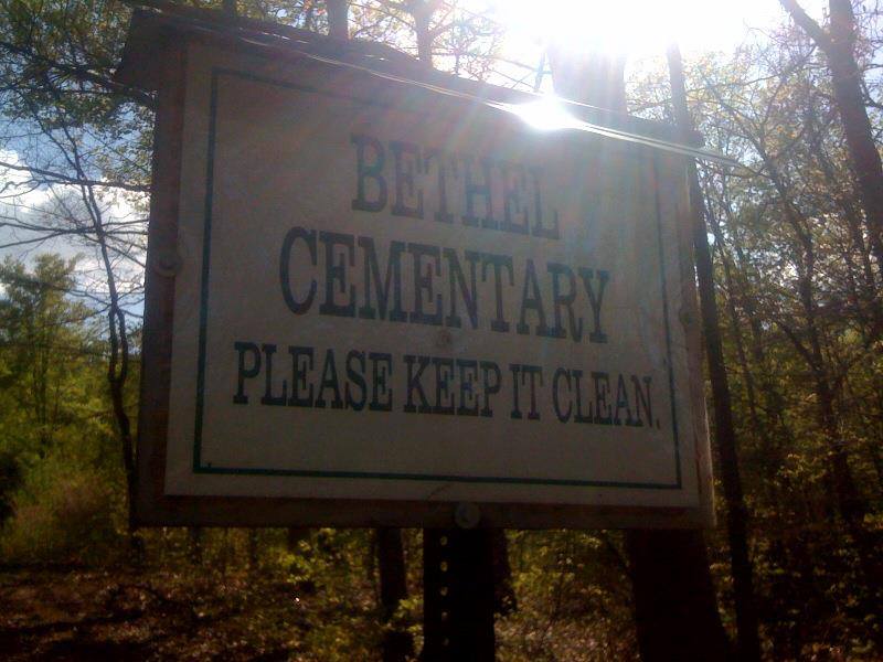
Haydenville and its industries were hit hard by the Great Depression. The railroad tunnel was abandoned in 1957 and the company went out of business in 1965, giving Haydenville the distinction of being Ohio’s last company town. Haydenville’s historic district was listed on the National Register of Historic Places in 1973. Ohio Historical Marker #4 – 37 at 1635 Haydenville Rd tells much of the town’s story. Many of the early residents were buried in Haydenville Cemetery on Howard Rd.
Jobs, OH (Jobs Hollow) – (late 1800s – mid-1900s coal and railroad town abandoned over time)
Classification: ghost town
Location: Ward Township, Hocking County – On Jobs – New Pittsburg Rd at the intersection of Hoodlet Rd along Brush Fork
The town was named after William Job (1843 – 1931) who was one of the most prominent coal company operators in the Hocking Valley. It had several mines, a row of houses, a school, and a post office from 1890 – 1924. The train station was on the Brush Fork Branch of the Hocking Valley Railway. On May 13, 1892 the residents of Jobs broke the world record for mining coal in a single day with 4,888 tons loaded into 243 cars. The mines were owned by the Morris Coal Company at the time.
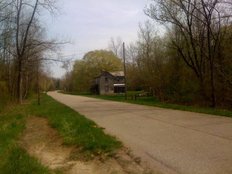
They were last operated by the Sunday Creek Coal Co. who recently sold the land to the state. It’s now managed by the Ohio Department of Natural Resources. They’re going to turn it into a wildlife area. Jobs Church and last standing house on Jobs – New Pittburg Rd were demolished in 2013. Any remaining open mine entrances will also be covered up. Jobs and the nearby former mining town of New Pittsburg, just to the northwest on Jobs – New Pittsburg Rd, are both still listed as populated places in the state despite having zero residents and no buildings.
Thanks to group member Brett Taylor, manager of Ohio Hiking Trails and Historical Sites, for the listing lead, pic, and providing most of the info on Jobs! Thanks also to Tom Young from Zanesville for updating us on the status of the town in October of 2013!
Murray City, OH – (1873 – present coal mining and railroad town slowly abandoned over time)
Classification: small town
Location: Ward Township, Hocking County – On SR 78 at the intersection of SR 216
It was named after John Murray Brown (1839 – 1893), an early settler who bought up the land and laid out the town in 1873. He also built a hotel in 1875 for local workers but sold out his interests in the community a few years later to a larger coal company. Brown moved to Somerset, OH, then Columbus, and later Detroit, MI where he died and was buried in Woodmere Cemetery.
Murray City was incorporated in 1891 and was once one of the largest coal towns in the country with over 2,000 residents. It had a semi-pro football team in the 1920s, the Murray City Tigers, which is now in the Pro Football Hall Of Fame. The town continues to lose more residents since the mines shut down with a current population of around 450. Its former train depot has been converted into a museum.
Thanks to group member Tammy Altman for providing the info on John Murray Brown!
Orbiston, OH – (1877 – mid-1950s iron furnace and coal town abandoned over time)
Classification: small town
Location: Ward Township, Hocking County and Trimble Township, Athens County – Off of SR 78 near the intersection of York Rd
Orbiston grew quickly in its early days after Ogden Furnace was built in 1877 by the Ogden Iron Company. Most of the local residents mined coal and iron for furnace production and some had jobs on the Hocking Valley Railway that ran through town. The furnace was sold a few times over the years and was eventually owned by the Hocking Iron Co. who changed the name to Helen Furnace. Orbiston had a population of about 500 is 1883, a post office that ran from 1877 – 1924, and a school that existed until sometime around 1930.
It’s unknown if there’s anything left of the furnace, but we suspect some foundations from other buildings are likely around the area, and maybe a few mine shaft entrances. Most of the residents were buried in Bethel Ridge Cemetery (Athens County). From Orbiston, just north of where the town was, make a right turn onto Goose Run Rd and take the first right onto a small gravel road.
Thanks to group member Brett Taylor, manager of Ohio Hiking Trails and Historical Sites, and his sister Debby Taylor for providing the listing lead, pic, and some of the info on Orbiston!

