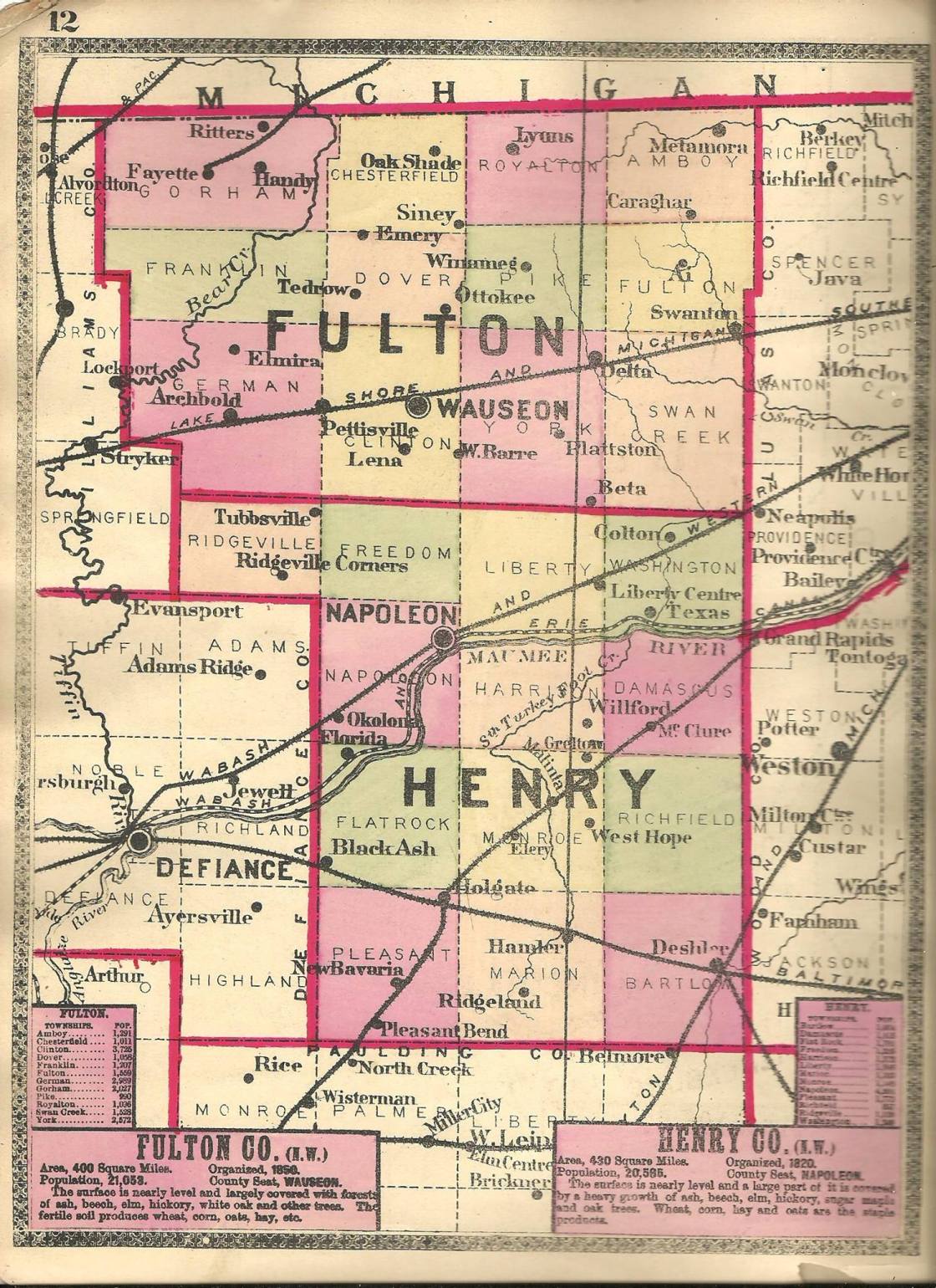
Ackley Corners – Gorham Township (formerly Mill Creek Township, Williams County)
Location: 41.680850, -84.360283
on US 127 (Meridian Rd) at the intersection of Township Rd S along Spring Creek
Remnants: none known
Description: The town was founded by Calvin Ackley (1815 – 1906) from New York and Gertrude (Walker) Ackley (1817 – 1854) from New Jersey. They got married in Fairfield County in 1837 and moved to Fulton County in 1840. Calvin and Gertrude had 5 children and accumulated a farm of approximately 250 acres at the intersection. Calvin was a farmer, justice of the peace, school board member, and a land agent for the Greenland Company which held deeds for several thousand acres in the area. The family also owned a steam-powered saw mill on the north side of Township Rd S just east of the GPS coordinates. The first school was on the Ackley Farm on north side of Township Rd S just west of the GPS coordinates. A newer school (Gorham Township No. 4) was built across road by publication of the 1875 county atlas and was also on the Ackley Farm. Calvin remarried after Gertrude passed away. They were buried with relatives in Pleasant View Union Cemetery 2 1/2 miles southeast of the GPS coordinates on Maple St in Fayette.
Allston (Alston) – Franklin Township
Post Office: 1854 – 1859
Location: 41.601443, -84.300485
on Co Rd J between Co Rd 23 and Co Rd 22
Remnants: none known
Description: The proprietor, Orren G. Greely (1820 – 1909), was the town’s only postmaster. A school was on the south side of the road at the GPS coordinates on a farm owned by the Bowser family during the time the post office was in existence. Orren was mentioned as an early settler in the township in the old county history books with no other info. His first wife was Letticia (Prettyman) Greely (1822 – 1861) inherited her family’s homestead on the north side of the GPS coordinates. The owner was listed as T. W. Prettyman on the 1858 county map. Orren and Letticia had one son together, Lewis Allston Greeley (1849 – 1935). Orren married Matilda Greely (1829 – 1921) after Letticia passed away. They also had a son together, Theodore Parker Greeley (1864 – 1925). Most of the names in the family have alternative spellings in historical records. Orren is also listed as Orrin and Orin. Letticia can be found with Leticia and Laticia. Lewis was listed in the 1870 census as Allston. It’s unknown when the extra “e” was added to the surname, as may be the case in other branches of the family around the state. Lewis was buried with relatives in Wauseon Union Cemetery about 11 miles southeast of the GPS coordinates at the intersection of SR 2 and County Rd 15-1 in Wauseon in Clinton Township. Theodore was buried with relatives in West Franklin Cemetery 6 1/2 miles northwest of the GPS coordinates at the intersection of Co Rd L and Township Rd 27-2. Orren, Letticia, and Matilda were laid to rest in Johnson (Sand Hill) Cemetery 3 1/3 miles southwest of the GPS coordinates on the south side of US Hwy 20A in German Township.
Ambrose – Franklin Township
Post Office – 1890 – 1901
Location: 41.623307, -84.277206
on Co Rd L at the intersection of County Rd 21-2
Remnants: former school 1/2 of a mile west of the GPS coordinates in the southwest lot of the intersection of Co Rd L and Co Rd 22, former Baptist church about 1 1/4 miles east of the GPS coordinates on the north side of Co Rd L just west of Township Rd 20-1
Description: Ambrose was spread out along a couple mile stretch of Co Rd L. The former school (Franklin Township No. 2) is now a private residence and former Baptist church also appears to be part of a private residence these days. Another school (Franklin Township No. 1) was on the east side of the church and has since been lost to time. A saw mill and a cheese factory were 1/2 of a mile east of the GPS coordinates in the northwest corner of the intersection of Co Rd L and Co Rd 21 on a 50-acre farm owned by Albert Doriat (1850 – 1942) and Mary Jane (Barnes) Doriat (1858 – 1919) who got married in 1875. All of the mentioned buildings can be found pinpointed on page 21 of the 1888 county atlas. The known postmasters were E. E. Buxton, John R. Brown (1858 – 1906), and Civil War veteran Leander Buxton (1842 – 1928). Mary Doriat and John Brown were buried in Smith Cemetery 4 1/2 miles southest of the GPS coordinates at the intersection of Co Rd 19 and Township Rd Hj. Albert Doriat was laid to rest in Masonic Home Cemetery on Acacia Ln in Springfield, Clark County. Leander Buxton was buried with relatives in Wauseon Union Cemetery about 12 miles southeast of the GPS coordinates at the intersection of SR 2 and County Rd 15-1 in Wauseon in Clinton Township.
Batdorf – York Township (formerly in Lucas County)
Post Office: 1888 – 1901
Location: 41.544269, -84.076290
on County Rd E at the intersection of Co Rd 11
Remnants: Zion United Methodist Church and Cemetery 1/2 of a mile south of the GPS coordinates on the west side of Co Rd 11
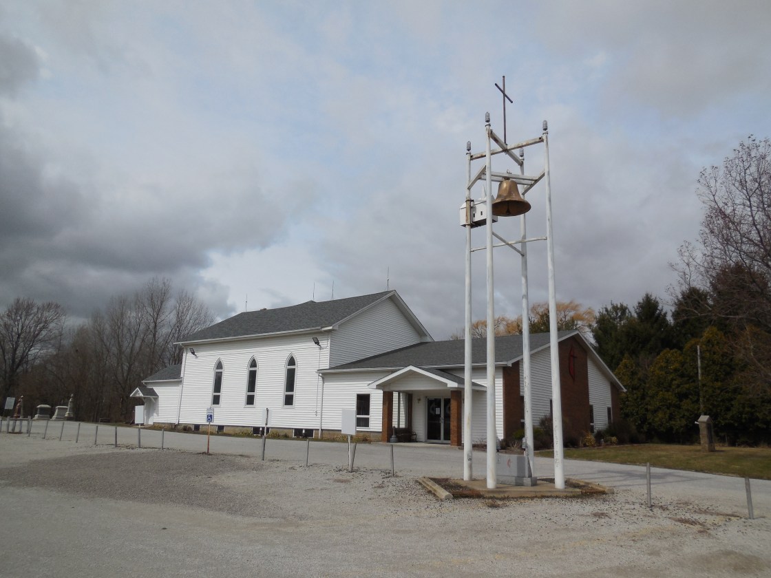
Description: John Batdorf (1818 – 1895) from Pennsylvania and Elizabeth (Morgan) Batdorf (1819 – 1896) from Virginia lived in Wayne County for a few years before moving to Fulton County in 1842. They had a large family and donated land for a school in the mid-1800s on their 160-acre farm on the east side of the GPS coordinates. It was replaced by a couple of local schools prior to publication of the 1888 county atlas, York Township No. 6 a mile south of the GPS coordinates and York Township No. 7 a mile north of the GPS coordinates. The Zion congregation formed as the Batdorf Class in 1867. Their early meetings were held in the school until the present church structure was completed in 1869. The church has added extra rooms and been remodeled a few times over the decades to maintain its growing congregation. John and Elizabeth were buried with many relatives and other residents in Zion Cemetery. An alternative spelling of the surname is Batdorff. The known postmasters were E. E. Batdorf, Emanuel D. Batdorf (1839 – 1894), and Russell B. Batdorf (1867 – 1934).
Beta – York Township (formerly in Henry County)
Post Office: 1857 – 1901
Location: 41.501209, -84.008765
on SR 109 at the intersection of Township Rd B along Dry Creek
Remnants: none known
Description: Beta was a farming town with a post office that moved around a lot. The know postmasters were Samuel G. Aumead, Moses Wright, Alfred Black, John Heitterheimer, Stephen P. Hilborn, Alfred B. Gunn, and John Elton. Alfred Gunn (1820 – 1881) and Emiline (Shaw) Gunn (1817 – 1864) were both born in Massachusetts and moved to Ohio with their parents. They had a few children and owned a 320-acre farm on the south side of the GPS coordinates. Alfred served as the county commissioner, assessor, and justice of the peace. He remarried after Emaline passed away and had a few more children with Jane (Kempton) Gunn (1835 – 1909). The Gunns were buried with relatives in Raker Cemetery 3 1/4 miles northeast of the GPS coordinates at the intersection of County Rd 6-1 and Township Rd D in Swan Creek Township.
Blanc – Franklin Township (formerly in Lucas County)
Post Office: 1847 – 1865
Location: 41.622494, -84.342773
on County Rd L at the intersection of Co Rd 25
Remnants: none known
Description: Dr. Amos Kendall (1820 – 1884) was the first postmaster when the office was in Lucas County before Fulton County was formed in 1850. He was buried with relatives in Pleasant View Union Cemetery 4 1/2 miles north of the GPS coordinates on Maple St in the town of Fayette. Jabez Jones was the first postmaster when the area became part of Fulton County. He was succeeded by Reuben B. Mason (1826 – 1912) from New Jersey who was the postmaster for last 11 years until the office was discontinued. Reuben was laid to rest in Frontier Cemetery on the west side of Clark Rd in Woodbridge Township, Hillsdale County, Michigan.
Chesterfield – Chesterfield Township (formerly in Lucas County)
Post Office: 1837 – 1869
Location: 41.668489, -84.171805
on US 20 at the intersection of Co Rd 16
Remnants: Butler Cemetery on the west side of Co Rd 16 about 1/4 of a mile south of the intersection
Description: It was founded in the mid-1830s by Alfred C. Hough (1809 – 1888) from Onondaga County, New York. Alfred held the offices of school examiner and county auditor. He married Mary (Taylor) Hough (1810 – 1905), had a few children, and was buried with relatives in Wauseon Union Cemetery 10 miles south of the GPS coordinates at the intersection of SR 2 and County Rd 15-1 in Wauseon in Clinton Township. Alanson Briggs (1797 – 1877) was the first postmaster back when the office was in Lucas County prior to 1850. He was buried with relatives in Lyons Cemetery 7 miles northeast of the GPS coordinates on the south side of SR 120 (W Morenci St) in Royalton Township. Alfred C. Hough was the next known postmaster. James M. Hough (1819 – 1904) was the last postmaster and was buried with relatives in Rose (Hawley) Cemetery 2 miles north of the GPS coordinates on the west side of Co Rd 16 just north of Township Rd T. Harlow Butler (1798 – 1881) from New York and Mary (Hickox) Butler (1803 – 1869) deeded their family farm cemetery to the township in 1866 and were buried there with relatives and other residents from the town. Harlow served as the school examiner prior to Alfred.
Cottrells Corners (Gorham) (Handy) – Gorham Township (formerly Mill Creek Township, Williams County)
Post Office: 1837 – 1873 and 1856 – 1874
Location: 41.674362, -84.288370
on US 20 at the intersection of Township Rd 22 along Spring Brook
Remnants: none known
Description: Cottrells Corners was founded by Gorham Cottrell Sr. (1780 – 1853) and Althea (Whitmarsh) Cottrell (1788 – 1867). They got married in 1810, moved to Ohio from Hamshire County, Massachusetts, and had 8 children. Gorham and Althea were early settlers in the township, which was named after the family patriarch, and ran a successful farm. They also donated land for a school in the southwest corner of the intersection. It was replaced by a newer school (Gorham Township No. 7) on the north side of US 20 just east of the GPS coordinates prior to publication of the 1875 county atlas. A church was also on land owned by the Cottrell family 1 mile east of the GPS coordinates in the northwest corner of the intersection of US 20 and and Co Rd 23. It was last spotted on the 1858 county map. Gorham and Althea were buried with relatives in Pleasant View Union Cemetery 2 1/2 miles southwest of the GPS coordinates on Maple St in the town of Fayette. For some unknown reason, the town had two post offices in the vicinity with different names running at the same time. This has been confirmed through several resources and is the smallest town we’ve ever seen with this case. One of the offices was called Gorham and ran from 1837 – 1873. Its known postmasters were Erastus Cottrell who was a son of Gorham and Althea, Amos Boyd, Joseph O. Allen, E. B. Wightman, and Charles L. Allen. The other office was called Handy and ran from 1856 – 1874. Jared Parker (1819 – 1903) was its first postmaster and Joseph Cottrell (1815 – 1890), another son of Gorham and Althea, held the position for the last 11 years before it was discontinued. They were also buried laid to rest in Pleasant View Union Cemetery. Both of the post offices were made obsolete by the arrival of the Chicago & Canada Southern Railway in the nearby town of Fayette.
Emery (Chatfields Corners) – Dover Township (formerly in Lucas County)
Post Office: 1846 – 1903
Location: 41.630490, -84.189954
on Co Rd L at the intersection of Township Rd 17
Remnants: former one-room schoolhouse on the north side of Co Rd L about 1/4 of a mile east of the GPS coordinates
Description: The original proprietors were Lucius Chatfield (1807 – 1884) from New Haven County, Connecticut and Malinda (Rose) Chatfield (1807 – 1896) from Geauga County. They met in Ohio, got married in 1828, and had a few children. Lucius was buried with relatives in Ottokee Cemetery 4 3/4 miles southeast of the GPS coordinates on the south side of Co Rd J between SR 108 and Township Rd 14. Malinda moved out of the state with their son Joel after Lucius passed away and was buried with relatives in Ford City Cemetery on State Hwy V in Gentry County, Missouri. Eben French, affectionately called “Old Man French”, also lived in the area and made the first oven for brick, tile, and pottery in Fulton County in the mid-1840s. The former school (Dover Township No. 2) appears to be in decent condition for its age and is used by a private residence. The post office was called Emery. Its known postmasters were Amos Gay, Lucius N. Chatfield, William Waid, Hiram Clark, Charles H. Waid, and Lemuel F. Waid.
Fluhart Corners (Essex) – York and Clinton Township (formerly in Lucas County) Post Office: 1844 – 1855
Location: 41.573416, -84.114934
on US Hwy 20A (Airport Hwy) at the intersection of Co Rd 13
Remnants: Fluhart (McClarren) Cemetery on the east side of Co Rd 13 about 1/3 of a mile north of the intersection
Description: The town was founded by Henry Fluhart (1801 – 1869) from Crawford County Pennsylvania and Nancy (Jewell) Fluhart (1810 – 1895) from Fayette County, Pennsylvania. They got married in 1827, owned an 80-acre farm on the east side of the intersection in York Township, and has at least 12 children. Although it wasn’t exactly a booming area with variety of industries, Fluhart Corners was considered among a handful of other locations to potentially be the county seat when Fulton was formed in 1850. The post office was called Essex. Its known postmasters were Smith Geer, Henry Fluhart, and Robert A. Howard. Smith Geer and a couple of the Fluhart family members were laid to rest in the cemetery with other residents. The Fluharts headed west shortly after the post office was discontinued. Henry was buried in Forest – Llewellyn Cemetery on N Centennial St in Kirkersville in Adair County, Missouri. Nancy was laid to rest with relatives in Olivet Memorial Park (Mount Olivet Cemetery) on Hillside Blvd in Colma in San Mateo County, California.
Haller – York Township
Location: 41.561440, -84.056891
on Co Rd 10 at the railroad crossing between US Hwy 20A and Co Rd F
Remnants: Swan Creek Church of the Brethren 1/4 of a mile south of the GPS coordinates on Township Rd 10 at the intersection of Co Rd F, Berkebile Cemetery on the west side of Co Rd 10 about 1/2 of a mile south of the GPS coordinates
Description: Haller was on the Lake Shore & Michigan Southern Railway and the Toledo & Indianapolis Electric Railway in the late 1800s to early 1900s. It had a saw mill and tile works pinpointed on the west side of the GPS coordinates in 1888 county atlas. The town proprietor, F. H. Haller, owned a 50 acre lot on the northeast side of the GPS coordinates listed in the 1903 county atlas and acquired an interurban stop for the local residents on the electric railway. Swan Creek Church of the Brethren and Berkebile Cemetery predate the town’s existence.
Lavona – York Township
Post Office: 1850 – 1864
Location: unknown
Description: none found
Lena – Clinton Township
Post Office: 1852 – 1866 and 1875 – 1876
Location: 41.514925, -84.172955
on Township Rd 16 at the intersection of Co Rd C
Remnants: Lena Cemetery on the east side of Township Rd 16 north of the intersection
Description: This small farming town had a school and steam-powered grist mill.
Leslie – Amboy Township
Post Office: 1892 – 1898
Location: 41.685927, -83.951816
on County Rd 4-3 at the intersection of County Rd S along Tenmile Creek
Remnants: none known
Description: none found
Mill Creek – Gorham Township
Post Office: 1849 – 1863
Location: unknown, was in the southwest section of the township
Description: none found
Parchers Corners – Pike Township
Post Office: 1844 – 1857
Location: 41.603079, -84.023144
on County Rd 8-1 at the intersection of Co Rd J
Remnants: none known
Description: The town was founded by Lyman Parcher who ran the first post office in the township. It also had a school.
Pelton – Swan Creek Township
Post Office: 1899 – 1901
Location: 41.509838, -83.941388
on Township Rd 4 along Blue Creek between County Rd B and Township Rd C
Remnants: none known
Description: Pelton had a school and a general store that was built by the town founder Henry Remer Pelton (1858 – 1937).
Plattston – York Township
Post Office: 1887 – 1901
Location: 41.530024 -84.032729
on County Rd D at the railroad crossing between SR 109 and Township Rd 9
Remnants: none known
Description: It had a general store, blacksmith shop, and a school in the late 1800s to early 1900s.
Ritters (Ritters Station) – Gorham Township
Post Office: 1874 – 1912
Location: 41.702828, -84.269947
on Township Rd 21 (Ritter – Lauber Rd) along Iron Creek between Township Rd T and the Michigan border
Remnants: none known
Description: The town was founded by Jacob Ritter (1824 – 1904) from Pennsylvania and Carloline (Hicker) Ritter (1827 – 1907) from New York. They had a few children and donated land for a train station on the Canada Southern Railway. Jacob was a carpenter, railroad tie inspector, train ticket agent, the town postmaster, and built a grocery store. Jacob and Caroline were buried with relatives in Oak Grove Cemetery on the west side of North St (SR 156) in Morenci, MI.
Siney – Fulton, Amboy, Pike, and Royalton Township
Post Office: 1884 – 1901
Location: 41.656488, -83.996638
on County Rd N at the intersection of Co Rd 7
Remnants: none known
Description: Siney had a general store and post office run by Chapman Smith, a steam-powered saw mill nearby in Pike Township, and a Methodist Church on the Roayalton and Amboy Township border.
Townline – Amboy and Royalton Township
Location: 41.709773, -83.998556
on Co Rd 7 at the intersection of SR 120 along Little Bear Creek
Remnants: none known
Description: It’s original log Methodist church was on the Royalton side and a frame structure was built in 1867 on the Amboy side. A cheese factory owned by James Santee (1834 – 1904) and Calista Santee (1837 – 1905) was the biggest business in town. They were buried with relatives in Lyons Cemetery on SR 120 (W Morenci St) in Lyons.
Thelma – Gorham Township
Post Office: 1897 – 1901
Location: 41.641935, -84.248514
on Township Rd MN at the southern jog of Co Rd 20
Remnants: old houses and farm buildings in the area
Description: The post office didn’t last long but it was a busy farming village in the late 1800s with a steam-powered saw mill and a school.
Treadway (Tredway) – Amboy Township, Fulton County and Richfield Township, Lucas County
Location: 41.712161, -83.880181
on Fulton – Lucas Rd at the 4-way intersection of Sylvania – Metamora Rd and Co Rd U along Tenmile Creek
Remnants: none known
Description: The town was founded by the Reuben Tredway (1803 – 1886) from Jefferson County, New York and Nancy (Smith) Tredway (1800 – 1885) from Rutland County, Vermont. They got married in 1825 in New York, had 9 children, and owned a 90-acre farm in the southwest lot of the intersection. Garret Vrooman (1818 – 1899) and Salley (Tredway) Vrooman (1826 – 1897) owned a cooper shop on a 97-acre farm on the east side of the Tredway homestead. There was a school in the northwest corner of the intersection on the Fulton County side in the late 1800s and another one a mile east of the GPS coordinates in the northwest corner of the intersection of Sylvania – Metamora Rd and Lathrop Rd. Most of the Tredway family was laid to rest in Amboy Township Cemetery 3 1/2 miles southwest of the GPS coordinates at the intersection of SR 64 and County Rd S in Fulton County.
West Barre – York and Clinton Township
Post Office: 1851 – 1872
Location: 41.515360, -84.114861
on Township Rd C at the 5 way intersection with Co Rd 13
Remnants: West Barre Cemetery on private property in the northeast lot of the intersection
Description: It was named after a tombstone company that was based in Barre, Vermont and had a distributing facility in the area. The town also had two churches, a general store, steam-powered saw mill, blacksmith shop, grange hall, ashery, and a school.