
Anderson – Pierpont Township
Location: 41.726667, -80.582565
on Anderson Rd (Township Hwy 301) between Stanhope – Kelloggsville Rd (Co Hwy 33) and SR 7 (Conneaut Youngstown Rd)
Remnants: none known
Description: The proprietors were Civil War veteran George S. Anderson (1823 – 1889) and Mary Ann (Lintz) Anderson (1833 – 1909. They were both born in Pennsylvania, owned a 130-acre farm with 2 lots on the north side of the GPS coordinates, and had 3 children. George served in the 105th Ohio Volunteer Infantry and received a disability related discharge before becoming a farmer. The road was named after the family. George and Mary were laid to rest with relatives 3 miles northeast of the GPS coordinates in Evergreen Cemetery on Cemetery Rd in Pierpont. Their son George (1858 – 1924) was a prominent physician in the county. Another son, Frank (1858 – 1902) purchased a farm on the south side of the GPS coordinates, and their daughter Catherine (Anderson) Pottenger (1868 – 1948) continued farming on the old homestead.
Barnes Corners – Trumbull Township
Location: 41.678110, -80.910368
on Windsor – Mechanicsville Rd (Co Hwy 9) at the intersection of Riverdale Rd (Township Hwy 69)
Remnants: Riverdale (Barnes) (Cogswell) Cemetery in the woods on the south side of Riverdale Rd just west of the GPS coordinates
Description: It was named after the local Barnes (Barns) family and had a Catholic church in the northwest corner of the intersection. There was also a saw mill and a school on the south side of Riverdale Rd across the border in Morgan Township in the mid-1800s. The church and mill were gone prior to publication of the 1874 county atlas. Some members of the Barnes and Cogswell families, which were related by marriage, are interred in the cemetery. Neither of the families had any members left living in the area when the 1905 county atlas was published. Unfortunately, the cemetery isn’t in great shape these days due to slowly being overtaken by nature. Burials date back to at least the 1830s.
Damon – Windsor Township, Ashtabula County and Huntsburg Township, Geauga County
Post Office: 1896 – 1899
Location: 41.564254, -81.001853
on SR 86 (Plank Rd) at the intersection of Chardon – Windsor Rd
Remnants: none known
Description: This short lived farming and postal town had a school on the north side of SR 86 west of the GPS coordinates on land owned by the Larson family. C. F. Alexander was the postmaster.
Fargo – Ashtabula Township
Location: 41.865919, -80.772517
on State St at the intersection of E 44th St
Remnants: Edgewood Cemetery on the west side of State St just north of the GPS coordinates
Description: The town was founded by Jason Fargo (1790 – 1861) from Massachusetts and Clarissa (Harmon) Fargo (1801 – 1880). They got married in 1817, had several children, and owned a 156-acre farm. Jason was also the first township trustee. In the late 1800s, there was an express post office for Fargo on the New York, Chicago, & St. Louis Railroad (Nickel Plate Road) along the tracks just south of the GPS coordinates. Express offices didn’t have an appointed postmaster. Mail was normally hung in a bag on a pole and grabbed by a train attendant with a hook as they rolled by without stopping. Jason and Clarissa were buried in Edgewood Cemetery with some of their children, including Dan and Lucius who owned a very prosperous 570-acre farm.
Iona – Windsor Township
Post Office: 1898 – 1903
Location: 41.508649, -80.972898
on S Windsor Rd at the 4-way intersection of S Wiswell Rd and Girdle Rd
Remnants: none known
Description: Iona was a farming and postal town with a little village clustered around the GPS coordinates. It had a school (Windsor Township No. 1) in the northeast corner of the intersection on land donated by Samuel N. Sweet (1810 – 1891) and Olive (Ellis) Sweet (1813 – 1879) from New York. They moved to Trumbull County and were buried there with relatives in Fariview (Center) Cemetery on SR 534 (Phelps Creek Rd) in Mesopotamia. A Wesleyan Methodist church was in the southeast corner of the intersection on land donated by Benjamin W. Norris (1793 – 1876) from Connecticut. He was laid to rest with relatives in Windsor Township (Windsor Corners) Cemetery 4 miles northeast of the GPS coordinates on the west side of Noble Rd in Windsor. George G. Bacon (1860 – 1942) was the postmaster. He married Addie (Lampson) Bacon (1865 – 1939) from Meigs County and had 3 children. George and Addie later moved to Portage county and were buried there in Riverside Cemetery at the intersection of Allyn Rd and Winchell Rd in Hiram Township.
Osbornville (Phoenix) – Pierpont Township
Post Office: 1856 – 1860 and 1862 – 1903
Location: 41.790083, -80.623702
on Stanhope – Kelloggsville Rd at the intersection of Beckwith Rd along West Branch Ashtabuala River
Remnants: Graham Road Bridge about a mile southeast of the intersection on Graham Rd
Description: The town was in the northwest corner of the township in the section on the southeast side of the GPS coordinates. Its original proprietor was an M. Osborn who built a grist mill, saw mill, general store, and ran the post office. The name changed to Pheonix and had a post office by that name from 1862 – 1903. A shingle mill at the site was owned by Patrick & Hollister. Alfred Hollister (1821 – 1902) was the postmaster for over 40 years. He was succeeded by Charles H. Burkhart and Calvin H. Barber was the last postmaster. As quickly as Osbornville hit the maps, Pheonix disappeared just as fast after the post office closed and didn’t make it into the 1905 county atlas. Graham Road Bridge was constructed with wood salvaged from a former covered bridge that crossed West Branch Ashtabula River and was badly damaged in the Great Flood of 1913. The bridge was moved to its current spot for preservation in 1972.
Padens Mills – Monroe Township
Location: 41.884292, -80.618799
on State Rd at the intersection of Hatches Corners Rd
Remnants: none known
Description: The Paden family were Quakers who also owned 400 acres of land with a saw mill along Paden Creek in Crawford County, Pennsylvania. Jacob Paden was the patriarch and arrived in Monroe Township in 1805 or 1806. He constructed the first saw mill and grist mill in the township next to Bear Creek Waterfall in 1807. The grist mill was enlarged and improved in 1810 – 1811. The first distillery in the township was built by Jacob in partnership with William B. Frazier close to the mills. Jacob also owned the first general store in the township at the mill site. It was a small store, but certainly much better than nothing in those times. State Road Bridge just to the north of the GPS coordinates was constructed in 1983.
Sherman – Geneva and Saybrook Township
Location: 41.817462, -80.904346
on US 20 approximately halfway between Geneva and Saybrook
Remnants: none known
Description: Sherman’s status as a town didn’t last long. Its only known cartographic appearance was on the Ohio map in the 1901 George Cram atlas along the New York, Chicago, & St. Louis Railroad (Nickel Plate Road).
Steeles Corners – Cherry Valley Township
Location: 41.606931, -80.648752
on US 6 at the intersection of Hayes Rd
Remnants: none known
Description: Its original proprietors were Jesse Steele (1788 – 1853) and Theodocia (Woodruff) Steele (1787 – 1870s). They moved to Ohio from Connecticut, arrived in Ashtabula County in 1816, and had a few children. The family moved to Cherry Valley Township in 1827. There was a general store and a blacksmith shop in the northwest corner of the intersection in the mid-1800s. Alpheus W. Steele (1818 – 1907), a son of Jesse and Theodocia, owned a watch and jewelry repair shop at the same corner in the late 1800s. Steeles Corners faded out of existence prior to 1900 while being squeezed between the more popular towns of Cherry Valley and West Andover which are less than 3 miles apart. Alpheus was buried with relatives in Oakdale Cemetery 13 miles northwest of the GPS coordinates at the intersection of SR 167 (E Beech St) and N Market St in Jefferson. Jesse was buried with relatives in Cherry Valley Cemetery on the north side of US 6 about 1/2 of a mile west of the GPS coordinates. It’s unknown where Theodocia was buried.
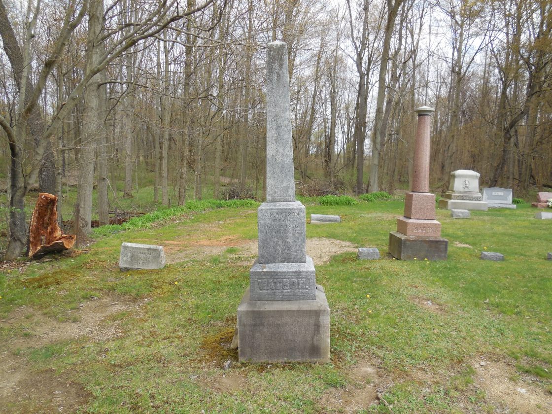
Watsons Corners – Colebrook Township
Location: 41.557506, -80.790356
on Fee Rd at the intersection of W Windsor Rd
Remnants: North Colebrook Cemetery on Fee Rd just south of the GPS coordinates
Description: The town was founded by Joseph Mitchell Watson (1822 – 1876) and Mary Jane (Courson) Watson (1821 – 1892). They had 8 children, moved to Ohio from Pennsylvania around 1870, and owned an 80-acre farm in the southwest lot of the intersection. A school was on their farm on the south side of W Windsor Rd west of the GPS coordinates and was pinpointed in the 1874 county atlas. Although it predates the family’s arrival in Ohio, North Colebrook Cemetery was also established on what was the Watson farm. Back then, it just comprised of the section on the east side of Fee Rd. Joseph and Mary Jane were buried with relatives and other early pioneers from the area in the cemetery, including the Beckwith family who previously owned the land and members of the Fee family who the road was named after.
*Tinker’s Hollow – Monroe Township*
GPS coordinates: 41.888163, -80.603368
Remnants: old bridge at the GPS coordinates
Description: Although it was never federally recognized as a populated place, Tinker’s Hollow is often referred to as a ghost town. The bridge is reportedly haunted and there is plenty of info around cyberspace concerning the location, which we will make no attempt to surpass at this time.
Harpersfield, OH – (1798 – present farming town with less residents than in the past)
Location: Harpersfield Township, Ashtabula County – On Harpersfield Rd at the intersection of SR 307 (N River Rd)
Classification: small town
In 1798 Revolutionary War veteran Colonel Alexander Harper (1744 – 1798) and Elizabeth (Bartholomew) Harper (1749 – 1833) settled on the banks of the Grand River and built a grist and saw mill. They moved there from Harpersfield, NY which was also named after the family. The Harpers are buried with some of their descendants in Harpersfield Cemetery at the corner of SR 307 (N River Rd) and Harper Valley Ln. There are also several other Revolutionary War veterans and early families from the town buried there. Harpersfield had a post office from 1804 – 1903 and is still a populated area.
A covered bridge was built in 1868 spanning Grand River. At 228 feet, it’s the second longest covered bridge in Ohio and has a small metropark surrounding it. The bridge is on the National Register of Historic Places and is highlighted by Ohio Historical Marker # 2 – 4 with some of its history. Ashtabula County also has a covered bridge festival at the fairgrounds every year.

Hartsgrove, OH – (1830 – present farming and merchant town with less residents than in the past)
Classification: small town
Location: Hartsgrove Township, Ashtabula County – At the intersection of US 6 and SR 534
Hartsgrove is more of a historical community than a ghost town, but aside from the cars rolling by, being in the town square feels more like the early 1900s than the early 2000s. The township is also called Hartsgrove but was originally Gladding Township. In 1806, John Gladding (1782 – 1853) and his wife Mary (Ritter) Gladding (1783 – 1853) came from Hartford, Connecticut and settled a farm along SR 534 between Hartsgrove and Windsor. Their son Joseph Gladding (1809 – 1866) and his wife Thankful (Norris) Gladding (1798 – 1878) later settled a few miles north near Hartsgrove and had several children. Half of the township was a wedding gift to one of their descendants, and sometime in the mid to late 1800s the township name was changed from Gladding to Hartsgrove.
The town was organized in 1830 and its post office ran from 1830 – 1905. Its square has a restored general store, the last one room schoolhouse, an old church, former meeting hall, and the Hartsgrove Emporium which housed a US presidents museum. There’s also a nice small park with a gazebo in the middle of the traffic roundabout in the town square. John and Mary Gladding were buried in Windsor Township Cemetery about 5 miles south of Hartsgrove on SR 534. Joseph and Thankful Gladding were buried with several of their ancestors in Hartsgrove Center Cemetery (Hartsgrove Township Cemetery) off of SR 534 just north of the town.

