Aults – Van Buren Township
Location: unknown
Description: none found
Bassingers (Basinger) – Riley Township
Location: 40.937994, -83.980998
on Rd Q (Township Rd Q) between SR 696 and Lehman Rd
Remnants: none known
Description: The town was along the Northern Ohio Railway and was founded by a branch of the Basinger family. There are no tracks left from the railroad, but its path can be seen on satellite maps north of the GPS coordinates. Most of the residents, including many members of the Basinger family, were buried in the cemeteries in Pandora.
Clevengers – Union Township
Location: 40.967736, -84.185517
on SR 115 between Rd Z (County Hwy Z) and County Hwy 16-O along the Ottawa River
Remnants: Clevenger Cemetery at the GPS coordinates, Thompson Primitive Baptist Church 2 miles south of the cemetery at the intersection of SR 115 and Rd P (County Hwy P)
Description: The original proprietors were George Clevenger (1808 – 1888) and Elizabeth (Sarber) Clevenger (1809 – 1897). They were farmers, settled in Union Township in 1830, and had a few children. George was elected as a township supervisor in 1835. The Clevenger family owned well over 1,000 acres of farmland along the Ottawa River in Washington Township south of Khalida by publication of the 1880 county atlas. A school was on the east side of SR 115 south of the GPS coordinates on land owned by Jacob Blosser (1830 – 1892) from York County, Pennsylvania and Sophronia (Sietz) Blosser (1833 – 1933) from Fairfield County. Another school on the east side of Rd 17N on a farm owned by the Runkel family served residents on the west side of the Ottawa River. The Clevengers and Blossers, were members of Thompson Primitive Baptist Church. Its congregation formed in 1869 and the current church was constructed in 1894. Everyone mentioned in this listing was buried in Clevenger Cemetery.
Cochran – Jennings Township
Post Office: 1841 – 1848
Location: unknown
Description: William Cochran Jr. was appointed to the county sheriff position in 1834 and was the town’s postmaster.
Cunningham
Post Office: 1839 – 1848
Location: unknown
Description: Henry Miller was the postmaster.
Dukes (Webster) (Stanley) – Riley Township, Putnam County and Union Township, Hancock County
Post Office: 1837 – 1854 and 1863 – 1891
Location: 40.967130, -83.887330
on SR 12 along Dukes Run between Rd 2 and Rd 1
Remnants: none known
Description: The town was founded by the Dukes family who arrived from Franklin County in the 1830s and the first post office was called Dukes from 1837 – 1851. There was a church on the north side of SR 12 near the GPS coordinates and a town hall on the south side of SR 12 across from the church. George W. Dukes (1830 – 1907) was the postmaster when the office was called Stanley from 1863 – 1891. The town name also changed to Webster sometime during that time period. It was never platted, last spotted in the 1880 county atlas, and didn’t make it into the 1895 county atlas. George W. Dukes was buried with relatives in Maple Grove Cemetery 13 miles northeast of the GPS coordinates on the north side of SR 12 (W Main Cross St) in Findlay. Dukes Cemetery is 8 miles northeast of the GPS coordinates on the south side of US 224 between Township Rd 120 and Township Rd 123 in Blanchard Township, Hancock County. Descendants of the Duke family still live along Duke Run in the vicinity of the former town and continue their historical tradition in the local farming industry.
Franconia – Perry Township
Post Office: 1837 – 1867
Location: 41.042317, -84.302269
on SR 634 at the intersection of Rd 122 along the Auglaize River at the confluence of Blanchard River
Remnants: Franconia Cemetery south of the GPS coordinates between SR 634 and the Auglaize River
Description: Amos Kendall platted Franconia in 1837. It had a tavern operated by Pearson Holden (1802 – 1867) who was also the first postmaster, a general store originally owned by Parlee Carlin (1805 – 1883), and was a busy trading point for early settlers. Peter Myers (1800 – 1879) was the last postmaster. The town faded out of existence well before publication of the 1880 county history book. Pearson was buried with relatives in Holden Cemetery 3 1/2 south of the GPS coordinates on the southwest side of Rd 22K. Parlee was buried with relatives in Maple Grove Cemetery on SR 12 (W Main Cross St) in Findlay. Peter was buried with residents and relatives in Franconia Cemetery.
Huntstown – Jackson and Perry Township
Post Office: 1879 – 1896
Location: 41.005328, -84.303558
on Rd L at the former railroad crossing between SR 634 and Rd 24
Remnants: none known
Description: It was platted with 22 lots in 1888 by Samuel Stuckey (1846 – 1934) from Fairfield County and had a train station on the Toledo, Delphos, & Burlington Railroad (later reorganized as the Toledo, St. Louis, & Kansas City Railway). Samuel was a justice of the peace, operated a general store, and was the town’s first postmaster. He married Rebecca (Wildermuth) Stuckey (1852 – 1920) in 1876 and had one daughter. They later moved to Franklin County and were buried in Obetz Cemetery on Groveport Rd on the southeast side of Columbus. Huntstown also had a school along the railroad tracks south of the GPS coordinates on land owned by the Hitchcock family. It was once a promising farming town, but lost the local business competition to Cloverdale, platted just a mile to the north in 1877.
Leon – Perry Township
Location: 41.064045, -84.246636
on Rd H at the intersection of Rd 20
Remnants: none known
Description: It was along the Columbus & Lake Michigan Railroad.
Madeira – Liberty Township, Putnam County and Marion Township, Henry County
Location: 41.166763, -84.054569
on Rd 10 at the intersection of Henry County Rd A
Remnants: none known
Description: Madeira’s only claim to fame was being mentioned as a small place in the 1847 first edition of Henry Howe’s Historical Collections Of Ohio.
Oakdale – Van Buren Township
Post Office: 1872 – 1873
Location: 41.132951, -83.957667
on Rd 5 (Co Hwy 5) at the railroad crossing between SR 65 (Iams Ave) and Rd C
Remnants: none known
Description: The town was on the Cincinnati, Hamilton, & Dayton Railroad and had a saw mill and lumber yard owned by Daniel Kelley (1856 – 1926) and Idella (Compton) Kelley (1866 – 1948) west of the railroad tracks on the south side of Rd C. There was a school in the northwest corner of the intersection of Rd C and R5 on land owned by German immigrants John Dehnart (1823 – 1891) and Catherine Dehnart (1831 – 1883). Everyone mentioned in this listing was buried with relatives in Sugar Ridge Cemetery 3 1/2 miles south of the GPS coordinates on the north side of SR 613 (E Main St) west of County Hwy 5 (Protec Pkwy).
Philander
Post Office: 1892 – 1896
Location: unknown
Description: Philip S. Carr was the postmaster.
Sugar Ridge – Van Buren Township
Post Office: 1854 – 1865
Location: 41.091228, -83.965655
on SR 613 (E Main St) between Rd 5-F and Protec Pkwy (County Hwy 5)
Remnants: Sugar Ridge Cemetery at the GPS Coordinates, Sugar Ridge Van Buren Cemetery on the west side of Sugar Ridge Cemetery, former church on the north side of SR 613 near the GPS coordinates, St. Mary’s Cemetery on Rd 5-F
Description: This small farming and postal town fell off of maps as Leipsic grew. E. H. Alward was the postmaster. The former church on the north side of SR 613 has an unusual looking block construction. Many township and county pioneers were buried in the extensive cemetery grounds around the area.
Upper Tauwa – Ottawa Township
Location: 41.013385, -84.020777
on the south side of SR 224 between E 2nd St and Rd 8 along the Blanchard River
Remnants: none known
Description: This Ottawa Native American town was in existence for several decades up to the early 1830s.
Wards – Liberty Township
Location: 41.103021, -84.073181
on Rd 11 at the railroad crossing between SR 613 and County Hwy E (Rd E)
Remnants: none known
Description: Wards was a small farming town on the New York, Chicago, & St. Louis Railroad (Nickel Plate Road) in the late 1800s to early 1900s.
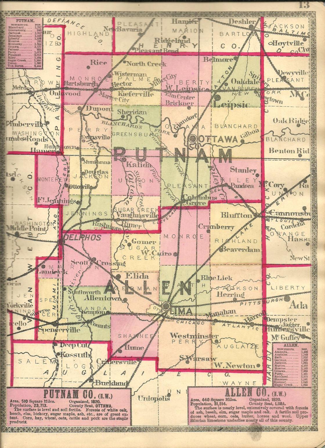
Belmore, OH – (1862 – present farming, mill, and railroad town with less residents than in the past)
Classification: semi-ghost town
Location: Van Buren Township, Putnam County – On Main St off of SR 65
Belmore was platted in 1862 by Wesley G. Montgomery (1813 – 1892) and Julia (Plummer) Montgomery (1825 – 1859) with a power of attorney from Julia’s parents, Benjamin and Mary Ann Plummer, who owned the land at the time. It was initially called Montgomeryville but the name changed in 1868 to coincide with the post office that was named Belmore. The town plat had 17 lots to start out with and began to expand with a train station on the Cincinnati, Hamilton, & Dayton Railroad in 1869.
In the 1870s, Belmore had a mill, hotel, a couple of grocery stores, and several other small stores and businesses. The population peaked in the 1880s with around 450 residents. Although Belmore was a railroad town, it didn’t get any big businesses in the 1900s to make the population boom. A school was built in 1904 and unfortunately was destroyed in a fire in 1958. The railroad station eventually closed, as did the post office in 1964.
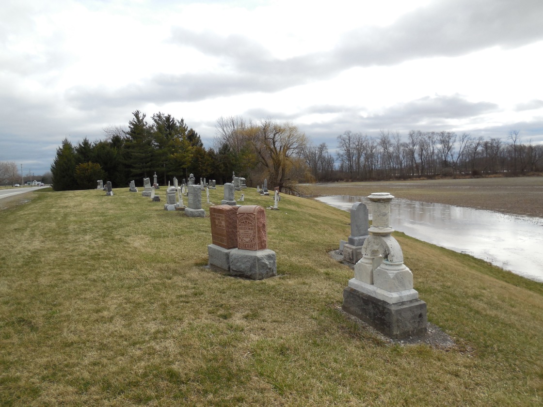
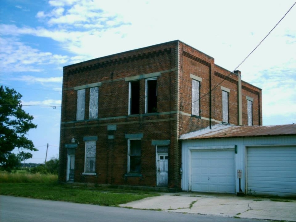
These days, Belmore has a newer railroad line running through its center but no train station. A CSX train passed by when we were there in July 2014. The old town hall built in 1908 sits abandoned on Main St near an empty church. There are also several other old abandoned businesses on Main St and the town’s cemeteries, East Belmore and West Belmore, are on Road Y. It’s a cool place to swing by right off of SR 65 with a close-knit community of about 120 residents.